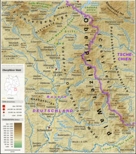
Podčeskoleská pahorkatina
| Podčeskoleská pahorkatina
"Hill country near the Upper Palatinate Forest"
|
|
|---|---|
| Highest peak | Chebský vršek ( 679 m nm ) |
| location | Czech Republic |
| Coordinates | 49 ° 57 ' N , 12 ° 41' E |
| Type | Sink |
| surface | 746 km² |
Podčeskoleská pahorkatina ("hill country near the Upper Palatinate Forest") is a geomorphological unit and rough highland that extends in the sunken area of the Cheb Domažlice moat.
geology
It lies on the crystalline rocks of Barrandium ( gneiss , paragneiss , mica , granite , amphibolite , gabro , diorite ). Extensive remains of tertiary flattened surfaces ( etchplains , pediplains ) and shallow tectonic basins with neogene sediments are numerous , in the central part there are a large number of ponds. Low depressions, structural ridges and weathering and erosion of granite rocks are evenly distributed.
natural reserve
The protected landscape area of Český les , designated in 2005, covers the entire area.
Waters
Dominant waters are the rivers Ohře (German: Eger) and Mže (German: Mies).
Geomorphological classification
- System: Hercynian
- Subsystem: Hercynian Mountains
- Province: Bohemian Massif ( Česká vysočina )
- Subprovince: Šumavská subprovincie (Bohemian Forest Subprovince)
- Area: Českoleská oblast (Upper Palatinate Forest area)
- Main unit: Podčeskoleská pahorkatina ("hill country near the Upper Palatinate Forest")
- Sub- unit: Tachovská brázda , Chodská pahorkatina ("Melhuter hill country")
Individual evidence
- ↑ Demek J. a kol .: Zeměpisný lexikon ČSR - Hory a nížiny , Academia, Praha 1987 s. 222

