Upper Palatinate Forest area
| Upper Palatinate Forest area
Českoleská oblast
|
|
|---|---|
|
Subgroup Českoleská oblast (marked in red) |
|
| Highest peak | Čerchov (Schwarzkopf) ( 1042 m nm ) |
| location | Czech Republic |
| part of | Bohemian mass |
| Classification according to | Geomorphological classification of the Czech Republic |
| Coordinates | 49 ° 23 ' N , 12 ° 47' E |
| surface | 1,741 km² |
The Upper Palatinate Forest Region ( Czech: Českoleská oblast) is a geomorphological area on the border between southwestern Bohemia and eastern Bavaria. Within the Czech geomorphological department, it belongs to the Bohemian Forest sub-province , together with the Bohemian Forest highlands connected to it in the southeast . In Bavaria it partially overlaps with the Upper Palatinate - Bavarian Forest area , which is defined within the German subdivision and corresponds to the German part of the sub-province of Bohemian Forest . In the north-west, the Českoleská oblast touches the Ore Mountains , Thuringian-Franconian Central Mountains ( Fichtel Mountains ), Podkrušnohorské pahorkatina (Eger Basin) and Karlovy Vary Mountains . In the northeast the Plzeňská pahorkatina .
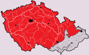
Geomorphological classification of the Czech Republic with the main group of the Bohemian Masses ( Česká vysočina , marked in red)
Position and extent
The German part is divided into the following units:
- Hinterer Oberpfälzer Wald (400, Upper Palatinate) - the highest part along the Czech-German border
- Upper Upper Palatinate Forest (401, Upper Palatinate)
- Cham-Further valley (402, Všerubská vrchovina)
Geomorphological classification
- System: Hercynian
- Subsystem: Hercynian Mountains
- Province: Bohemian Massif (Česká vysočina)
- Subprovince: Bohemian Forest Subprovince (Šumavská subprovincie)
- Area: Upper Palatinate Forest Region (Českoleská oblast)
- Main units: Upper Palatinate Forest (Český les), Podčeskoleská pahorkatina ("hill country near the Upper Palatinate Forest"), Cham-Further Senke (Všerubská vrchovina)
Individual evidence
- ↑ Walter Sperling: Geo names , keyword Česká vysočina in the dictionary of Prof. Dr. W. Sperling, accessed January 14, 2016
literature
- Jaromír Demek et al .: Zeměpisný lexikon ČSR. Hory a nižiny. Academia, Praha 1987, p. 35.

