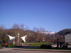
Pola de Laviana (Parroquia)
| Municipality of Laviana: Parroquia Pola de Laviana | ||
|---|---|---|
| coat of arms | Map of Spain | |

|
|
|
| Basic data | ||
| Autonomous Community : |
|
|
| Comarca : | Nalón | |
| Coordinates | 43 ° 15 ′ N , 5 ° 34 ′ W | |
| Height : | 265 msnm | |
| Area : | 9.8 km² | |
| Residents : | 9,106 (January 1, 2011) INE | |
| Population density : | 929.18 inhabitants / km² | |
| Postal code : | 33980 | |
| Area code: | 33032050000 | |
| Nearest airport : | Asturias airport | |
| administration | ||
| Address of the municipal administration: | Plaza Armando Palacio Valdes N ° 1
33980 - Pola de Laviana (Asturias) |
|
| Location of the municipality | ||

|
||
Pola de Laviana is one of the nine parroquias in the Laviana municipality of the Autonomous Region of Asturias in Spain .
geography
Pola de Laviana is a Parroquia with 9106 inhabitants (2011) and an area of 9.8 km². It is 265- 300 msnm . Pola de Laviana is the capital of the municipality of Laviana, and with its 8880 inhabitants (2011) the capital of the Parroquia of the same name.
Waters in the Parroquia
The Rio Nalon flows through the Parroquia and two smaller tributaries flow directly into it.
mountains
The Peña Mea, 1560 msnm, is the largest elevation in the Parroquia and the entire municipality.
Transport links
The nearest airport is Oviedo .
economy
Coal , iron and copper have been mined since ancient times, and the tourism industry is still building on them today. Agriculture and forestry have shaped the region since time immemorial.
climate
Pleasantly mild summers with mild, rarely severe winters. In the high areas, winters can be quite severe.
Attractions
- Parish church of Nuestra Señora de la Asunción , built in 1895 in neo-Gothic style
- Church Nuestra Señora del Otero from the 15th century with the cruz latina
- San José Chapel
Villages and hamlets
- Pola de Laviana
- Las Portillas
- Quinta Norte
- Quinta Sur
- La Rasa
- La Rebollada
- Rebolloso
- Sertera
- Canto de Abajo
- Canto de Arriba
- La Carba
- Casapapio
- Castanal
- El Castrillon
- Felgueron
- Sospelaya - uninhabited (2011) 43 ° 14 ′ 45 ″ N , 5 ° 33 ′ 25 ″ W
- Abajo Valdelasabejas
- Carba de las Llanas
- La Chalana - uninhabited (2011)
- Horron de Arriba
- Llancuervo - 2 inhabitants (2011)
- El Lloson - 2 residents (2011)
- Omedines - uninhabited (2011)
- Las Llanas
- Lloreo
- Ortigosa
- Pielgos
- Piniella
- Otero Sur
- Pando
- El Robledal
- Solavelea - uninhabited (2011)
- La Traviesa- uninhabited (2011)
- Valdelasabejas-Arriba - uninhabited (2011)
- Vallebregon
- Tirana
swell
- Population figures see INE
- Postcodes see [1]
- For coordinates and heights, see Google Earth
Web links
- Parroquia side of the (English)

