Ponta Mano Tala
| Ponta Mano Tala | ||
| Geographical location | ||
|
|
||
| Coordinates | 8 ° 10 ′ S , 125 ° 39 ′ E | |
| coast | West coast of Atauros | |
| Waters | Wetar Strait | |
 Map of Atauro (borders until 2015) |
||
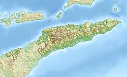
Ponta Mano Tala is a cape on the East Timorese island of Atauro , which lies in front of the state capital Dili . It is located in the north of the island, on the west coast in Suco Biqueli , between the villages of Douro and Arlo . Until 2015 the cape was still part of the Suco Beloi .
Individual evidence
- ^ Timor-Leste GIS-Portal ( Memento from June 30, 2007 in the Internet Archive )
- ↑ Ministry of State Administration and Territorial Management : Map of the Atauro Administration Office ( Memento of July 6, 2017 in the Internet Archive ), accessed on March 1, 2017.
