Porthkerry
|
Porthkerry Welsh Porthceri |
||
|---|---|---|
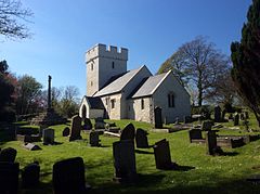
| St Curig, a church in Porthkerry | ||
| Coordinates | 51 ° 23 ′ N , 3 ° 19 ′ W | |
| OS National Grid | ST 08295 66663 | |
|
|
||
| administration | ||
| Post town | BARRY | |
| ZIP code section | CF62 | |
| Part of the country | Wales | |
| Unitary authority | Vale of Glamorgan | |
| British Parliament | Vale of Glamorgan | |
| Welsh Parliament | Vale of Glamorgan | |
Porthkerry ( Welsh : Porthceri ) is a small village on the Bristol Channel in the Rhoose community in the Welsh principal area of Vale of Glamorgan .
geography
Porthkerry is about 41.8 meters above sea level on the coast of the Bristol Channel . Porthkerry belongs to the Rhoose community , in the east of which it can be found.
| Tredogan | ||
| Rhoose |

|
Barry |
history
The Porthkerry area was settled in what is now Great Britain before the Romans arrived . An example of this is a site called The Bulwark , which is believed to have been found around 2000 BC. It was inhabited and was important as a strategic point with views over the Bristol Channel. The residents' legacies are earthworks and ditches. There were also other small settlements in the area. The relatively dense settlement is explained by the good condition of the soil around Porthkerry. After the invasion by the Roman Empire, the region fell to Porthkerry because of the abundance of good for mortar and cement suitable limestone into focus. There are speculations that the name Porthceri also comes from the period of the Roman invasion: At this time there was already a kind of harbor in the region around the village and Ceri ap Caid, a son of Caratacus , was called by the Romans in South Wales Deputy governor installed. Therefore, there are suspicions that Ceri ap Caid expanded the port considerably and that a place near the port of Porthceri was named for this reason . However, the port probably only became a larger port when over a hundred ships were stationed there as part of the Classis Britannica in 286 AD .
1093 landed in Porthkerry Robert Fitzhamon and twelve of his followers, who later brought parts of Wales under their control. Around 1600 there is evidence that a castle existed near Porthkerry , but there are no traces of it today. In 1607, Porthkerry, like many other places on the Bristol Channel, was hit by the floods on the Bristol Channel in 1607 , and there are also suspicions that this also destroyed the port of Porthkerry. For the centuries that followed, Porthkerry was a smaller settlement of houses. In the 19th century, the politician and cricketer Edward Romilly lived in Porthkerry , whose family donated the Porthkerry Country Park and whose grave can be found near St Curig.
traffic
A railway line of the Vale of Glamorgan line runs through Porthkerry . On October 2, 2014, the last two wagons of a freight train derailed in Porthkerry due to a defect in a rail. There is also a bus service in Porthkerry that runs between Bridgend and Llantwit Major or Barry . Porthkerry is also located southeast of Cardiff Airport .
Buildings
The church of St Curig is at least from the 15th century. In the 18th century, John Wesley preached several times in the church, while it was restored in 1987 and later gradually maintained or expanded. To the northeast of Porthkerry is the Porthkerry Country Park , a landscape park in which the Porthkerry Viaduct can also be found.
A total of five buildings in Porthkerry have been included in the Statutory List of Buildings of Special Architectural or Historic Interest . These are the church of St Curig, a cross in the churchyard of St Curig, the farmhouse of the Glebe Farm and an outbuilding of the farm as well as the old school house of the village. St Curig and the farm buildings are Grade II * buildings , the Cross and Schoolhouse are Grade II buildings .
Web links
- Website of the Parish Porthkerry and Rhoose
Individual evidence
- ^ A b c The History of the Village of Porthkerry. The Parish of Porthkerry and Rhoose, accessed May 10, 2020 .
- ↑ Porthceri, The Vale of Glamorgan (Bro Morgannwg) (or Porthkerry). In: getoutside.ordnancesurvey.co.uk. Ordnance Survey, accessed May 10, 2020 .
- ^ A b Rhoose Parish - Local Area Report. In: nomisweb.co.uk. University of Durham , accessed May 10, 2020 .
- ↑ Report 10/2015: Derailment at Porthkerry. gov.uk, August 6, 2015, accessed May 10, 2020 .
- ↑ Porthkerry. bustimes.org, accessed May 10, 2020 .
- ^ The History of St Curig's Church. The Parrish of Porthkerry and Rhoose, accessed May 10, 2020 .
- ↑ Porthkerry Country Park. Vale of Glamorgan Council, accessed May 10, 2020 .
- ^ A b Church of St Curig. British Listed Buildings, accessed May 10, 2020 .
- ^ A b Cross in the Churchyard of the Church of St Curig. British Listed Buildings, accessed May 10, 2020 .
- ↑ a b Church Farmhouse (aka Glebe Farm). British Listed Buildings, accessed May 10, 2020 .
- ↑ a b Outbuilding to north of Church Farm House. British Listed Buildings, accessed May 10, 2020 .
- ↑ a b The Old School House. British Listed Buildings, accessed May 10, 2020 .


