Pressure Bay
| Pressure Bay | ||
|---|---|---|
|
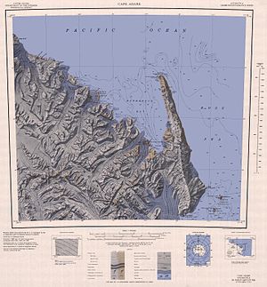
Map of Robertson Bay with Pressure Bay (a little left of center) |
||
| Waters | Robertson Bay | |
| Land mass | Victoria Land , East Antarctica | |
| Geographical location | 71 ° 25 ′ 0 ″ S , 169 ° 20 ′ 0 ″ E | |
|
|
||
| width | 5 km | |
| Tributaries | Frank Newnes Glacier , Shipley Glacier | |
The Pressure Bay is a 5-km wide sides booked the Robertson Bay on the Pennell Coast of the East Antarctic Victoria Land . Your entrance is limited to the west by Cape Wood and to the east by Birthday Point .
The bay was mapped by the northern group of the Terra Nova Expedition (1910-1913) led by the British polar explorer Victor Campbell (1875–1956 ). Name derives from passing through the opening into the bay was Shipley Glacier ice pressure caused ( English ice pressure ) leading to distortions in the sea ice led and so the progress of the northern group in this area considerably more difficult.
Web links
- Pressure Bay in the Geographic Names Information System of the United States Geological Survey (English)
- Pressure Bay on geographic.org (English)

