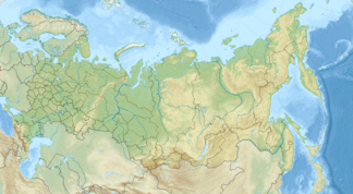
Prontschishchev back
| Prontschishchev back (Кряж Прончищева) |
||
|---|---|---|
| Highest peak | nameless elevation ( 291 m ) | |
| location | Sakha Republic , Siberia , Russia | |
| part of | North Siberian lowlands | |
|
|
||
| Coordinates | 73 ° 20 ′ N , 116 ° 46 ′ E | |
The Prontschishschew Ridge ( Russian Кряж Прончищева ) is a low mountain range up to 291 m high in the North Siberian Lowland , in the north of Siberia , Russia and in the northwest of the Republic of Sakha (Yakutia) ( Asia ).
Geographical location
The Prontschischtschew-back is as rocky mountain range in the east of the North Siberian Plain average of almost 770 km north of the northern Arctic circle and just south of the Arctic Ocean belonging Laptev Sea . It is located between the mouths of the rivers Anabar (with Anabar Bay and Anabargolf ) in the west and Olenjok (with Olenjokgolf ) in the east.
The mountain range with partly plateau-like elevations is a maximum of about 300 km long. Its average height is between 100 and 200 m , one of its highest elevations is called Chajalach ( 270 m ) and its highest is a nameless elevation (approx. 291 m) located a little east-southeast of it. The mountains are uninhabited.
Geology, climate and fauna
From a geological point of view, the mountains consist of Mesozoic sandstones and slates . The winters are extremely cold and long, the summers cold and short. Due to the northern location and the proximity of the Arctic Laptev Sea, permafrost , frost rubble deserts and tundra with typical vegetation of mosses and lichens predominate.
History and origin of name
The Russian polar explorer Eduard Toll (1858–1902) was the first researcher to map the landscape between Anabar and western Popigai and the mountain range of the Prontschishchev ridge located a little east of Anabar Bay between Anabar and eastern Olenjok in 1893. In honor of the Russian explorer and polar explorer Vasily Prontschishchev (1702–1736), whose expedition reached the mountain ridge and who described it in 1735, he gave the small mountain its current name.
Individual evidence
- ↑ a b Topographical map (1: 1,000,000, p. S-49,50, edition 1987), Prontschishchewa ridge (center right) and a. with Taimyr Peninsula (top left), khatanga gulf (left), Anabar , Anabarbucht and Anabar Bay (each approximately in the center), Laptev Sea (top right), Olenjokgolf (right), Olenjokdelta -Westteil (far right) on maps49.narod.ru ( with heights above sea )
