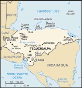
Puerto Cortés
| Puerto Cortés | ||
|---|---|---|
|
Coordinates: 15 ° 48 ′ N , 87 ° 57 ′ W Puerto Cortés on the map of Honduras
|
||
|
Location of Puerto Cortés in Honduras
|
||
| Basic data | ||
| Country | Honduras | |
| Department | Cortés | |
| City foundation | 1524 | |
| Residents | 81,000 | |
| Detailed data | ||
| surface | 391.2 km² | |
| prefix | (+504) | |
| Time zone | UTC −6 | |
| City Presidency | Alan Ramos | |
Puerto Cortés is a Honduran city in the department of Cortés .
geography
The city is on the Caribbean coast , north of San Pedro Sula and east of Omoa , 15.85 ° N; 87.94 ° W.
Puerto Cortés is the largest seaport in Honduras and the most important seaport in Central America . In 2003 the population of Puerto Cortés was 81,000.
history
The Conquistador Gil González Dávila founded the settlement of Villa de la Natividad de Nuestra Señora in 1524, roughly where Puerto Cortés is today. In 1526 La Natividad was renamed Puerto Caballos. 20 Spaniards who had previously lived in the towns of Nito and Naco settled there . In 1533 a local chief named Çiçumba destroyed the settlement; allegedly a woman from Seville , Spain , was also captured. After Çiçumba was defeated by Pedro de Alvarado in 1536 , a new city called Puerto de Caballos was founded. As it was vulnerable to pirates, it had few permanent residents in the 16th and 17th centuries. This only changed with the construction of the fortress in Omao by the Spanish in the 18th century.
The name Puerto de Caballos (port of the horses) arose from the fact that many horses drowned when Hernán Cortés arrived on the Honduran coast while unloading the ships. In 1869 the name Puerto Caballos was changed to Puerto Cortés in honor of Hernán Cortés .
The town
Puerto Cortés is home to the well-known Honduran soccer club Club Deportivo Platense , which was the first Honduran national soccer champion in 1966. In 2001 the club won the championship for the second time.
In August there is a two-week festival event in Puerto Cortés. The last day (a Saturday) is known as the Venedian Night (Noche Veneciana). August 15th is a local holiday in honor of the Virgen de la Asunción, the patron saint of Puerto Cortés.
In September 2001, the La Laguna (The Lagoon) bridge was rebuilt and opened after the old bridge, a 50-year-old structure, was badly damaged by Hurricane Mitch in 1998 and had to be demolished. A concrete wall was built near the La Laguna bridge to protect the coast. This wall is known as El Malecón, the Spanish word for 'pier' or 'landing bridge'.
The first four-lane expressway in Honduras opened in 1996. It connects San Pedro Sula with Puerto Cortés.
Mayor of the city
In 1982 a new statute for the election of mayors was introduced, previously the mayors were appointed by high-ranking government officials in Tegucigalpa .
- 1982–1983: Roy Reyes Orellana (Partido Liberal)
- 1984–1985: Mario Sabillón (Partido Liberal)
- 1986–1990: Romulo Montoya (Partido Liberal)
- 1990–1991: Rolando Méndez (Partido Nacional). He fled Honduras due to a corruption scandal.
- 1992: Rolando Orellana Cruz (Partido Nacional). He and the entire city council were ousted after a judge found them guilty of imposing an illegal tax on all cars entering Puerto Cortes during the Easter break.
- 1992–1993: Alvaro Zacarías Mena (Partido Nacional)
- 1994–1997: Marlon Guillermo Lara Orellana (Partido Liberal)
- 1998–2001: Marlon Guillermo Lara Orellana (Partido Liberal) (re-elected)
- 2002–2005: Marlon Guillermo Lara Orellana (Partido Liberal) (re-elected)
- since 2006: Alan Ramos (Partido Liberal)
Individual evidence
- ↑ http://www.azcentral.com/lavoz/spanish/latin-america/articles/latin-america_190549.html ( page no longer available , search in web archives ) Info: The link was automatically marked as defective. Please check the link according to the instructions and then remove this notice.
- ↑ Luis Suárez Fernández and others (eds.): Historia general de España y América , Vol. 7 El descubrimiento y la fundación de los reinos ultramarinos hasta fines del siglo XVI . Ediciones RIALP, Madrid 1982, ISBN 84-321-2102-9 , p. 299.
- ↑ Or Çoçumba, or Socremba, or Joamba; the exact name is not known as the Spaniards used many different names in their reports.

