Pungpa Ri
| Pungpa Ri | ||
|---|---|---|
|
View from Tong La (in the northeast): Pungpa Ri in the center of the picture, Nyanang Ri on the left , Phola Gangchen and Shishapangma on the right |
||
| height | 7445 m or 7486 m | |
| location | Tibet ( PR China ) | |
| Mountains | Jugal Himal ( Himalaya ) | |
| Dominance | 2.45 km → Shishapangma | |
| Notch height | 145 m ↓ ( 7300 m ) | |
| Coordinates | 28 ° 20 '3 " N , 85 ° 47' 39" E | |
|
|
||
| First ascent | May 19, 1982 by a British expedition | |
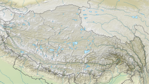
The Pungpa Ri is a 7445 m (according to other information 7486 m ) high peak in the Himalayan mountain range Jugal Himal in the south of Tibet ( People's Republic of China ).
The Pungpa Ri is due to a notch height of only 145 m as a secondary peak of the eight-thousander Shishapangma and not as an independent mountain. It is located 2.45 km southeast of the main summit of Shishapangma, with which it is connected by a mountain ridge.
Ascent history
A British expedition ( Douglas Scott , Alex MacIntyre and Roger Baxter-Jones ) succeeded on May 19, 1982, the first ascent of Pungpa Ri over the southwest face. As part of an attempt to climb Shishapangma, another British expedition ( Stephen Venables and Luke Hughes) managed to climb the summit for the second time on October 25, 1987 . On October 28th, two other expedition members, Nigel Williams and John Vlasto, reached the summit.
Web links
- Pungpa Ri on Peakbagger.com (English)
- Pungpa Ri at summitpost.org (English)
- Map and photo at himalaya-info.org
- Photo at mountainsoftravelphotos.com
Individual evidence
- ↑ Shishapangma's Southwest Face . AAJ, 1983, vol. 25th
- ^ A b Asia, Tibet, Pungpa Ri Second Ascent and Shisha Pangma Attempt . AAJ, 1988, vol. 30th

