Nyanang Ri
| Nyanang Ri | ||
|---|---|---|
|
View from Tong La (in the northeast): Nyanang Ri to the left of the center of the picture; on the right, Pungpa Ri , Phola Gangchen and Shishapangma |
||
| height | 7071 m | |
| location | Tibet ( PR China ) | |
| Mountains | Jugal Himal ( Himalaya ) | |
| Dominance | 3.11 km → Pungpa Ri | |
| Notch height | 471 m ↓ ( 6600 m ) | |
| Coordinates | 28 ° 18 '30 " N , 85 ° 48' 24" E | |
|
|
||
| First ascent | October 12, 1989 by Andrej Štremfelj , Stane Belak, Filip Bence and Pavle Kozjek | |
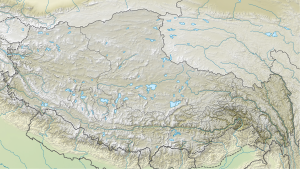
The Nyanang Ri is a 7071 m high mountain in the Himalayan Jugal Himal massif in Nyalam County in the south of Tibet ( People's Republic of China ).
The Nyanang Ri has a notch height of 471 m and is connected to the Pungpa Ri and the eight-thousander Shishapangma via a mountain ridge leading to the north-northwest . It is 3.11 km south of Pungpa Ri and 5.64 km south of the main peak of Shishapangma. The striking Ice Tooth summit ( 6240 m ) rises 2.65 km to the south . The Nyanang Phu Glacier flows to the west . At the foot of the east ridge of the Nyanang Ri is the mountain lake Kung Tso at an altitude of 5075 m .
Ascent history
As an acclimatization measure for a tour on the Shishapangma, a Yugoslav mountaineering group consisting of Andrej Štremfelj , Stane Belak, Filip Bence and Pavle Kozjek carried out a first ascent of the Nyanang Ri over the west ridge on October 12, 1989.
Web links
- Nyanang Ri on Peakbagger.com (English)
- Map and photo at himalaya-info.org
- Photo at mountainsoftravelphotos.com
- another photo at mountainsoftravelphotos.com
- another photo at mountainsoftravelphotos.com
Individual evidence
- ^ Asia, Tibet, Shisha Pangma from the Southwest and Nyang Ri . AAJ, 1990, vol. 32.

