
Jugal Himal
| Jugal Himal | |
|---|---|
 Aerial view of Shishapangma (left) |
|
| Highest peak | Shishapangma ( 8027 m ) |
| location | Tibet ( PR China ), Bagmati ( Nepal ) |
| part of | Himalayas |
| Coordinates | 28 ° 21 ′ N , 85 ° 47 ′ E |
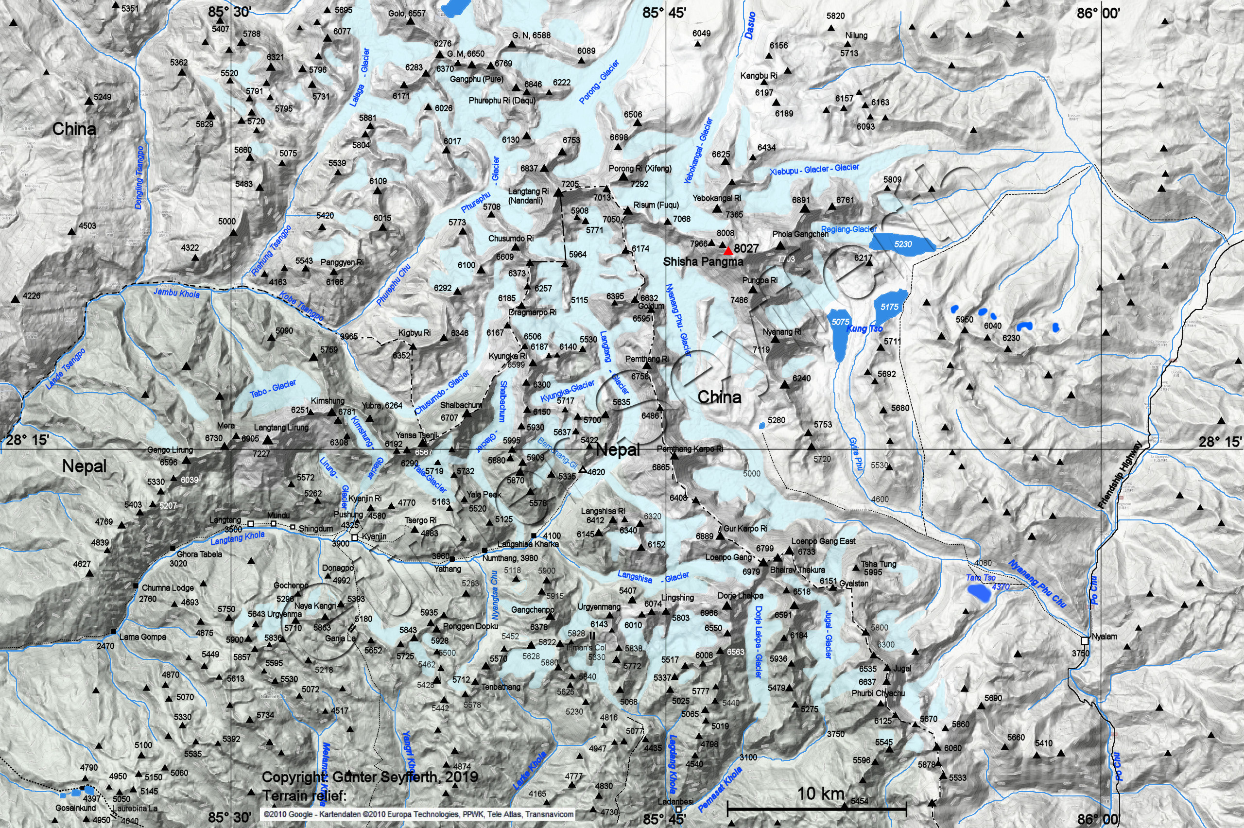
The Jugal Himal is a mountain range in the central Himalayas , 70 km north-northeast of Kathmandu , on the border between the autonomous region of Tibet ( People's Republic of China ) and Nepal .
The Jugal Himal stretches between the Sunkoshi river valley in the east and the Balephi Khola and Langtang Khola river valleys in the west. The highest peak is the 8027 m high Shishapangma . The mountain range is predominantly on the Tibetan side. In the west, beyond the Langtang valley, joins the lower Langtang Himal . To the south of the Langtang valley, the Chimsedang Lekh mountain range forms a western continuation of the Langtang Himal. The Tilman's Pass runs between the two mountain ranges.
Mountains and peaks
The most important peaks of the mountain range from north to south are:
| Surname | Height in m | country |
|---|---|---|
| Porong Ri | 7292 | People's Republic of China |
| Risum | 7050 | People's Republic of China |
| Yebokangal Ri * | 7365 | People's Republic of China |
| Shishapangma | 8027 | People's Republic of China |
| Phola Gangchen * ( Molamenqing ) | 7661 | People's Republic of China |
| Pungpa Ri * | 7445 | People's Republic of China |
| Nyanang Ri | 7071 | People's Republic of China |
| Pemthang Karpo Ri ( Dome Blanc ) | 6830 | Nepal / People's Republic of China |
| Langshisa Ri | 6427 | Nepal |
| Gurkarpo Ri | 6889 | Nepal / People's Republic of China |
| Loenpo Gang ( Big White Peak ) | 6979 | Nepal / People's Republic of China |
| Dorje Lhakpa | 6966 | Nepal |
| Urkeminmang | 6151 | Nepal |
* Yebokangal, Phola Gangchen and Pungpa Ri are only considered secondary peaks due to the notch height being too low.
Web links
- Map at himalaya-info.org