
Langtang Himal
| Langtang Himal | ||
|---|---|---|
.JPG) westernmost section of the Langtang Himal |
||
| Highest peak | Langtang Lirung ( 7227 m ) | |
| location | Bagmati ( Nepal ), Tibet ( PR China ) | |
| part of | Himalayas | |
|
||
| Coordinates | 28 ° 18 ′ N , 85 ° 39 ′ E | |

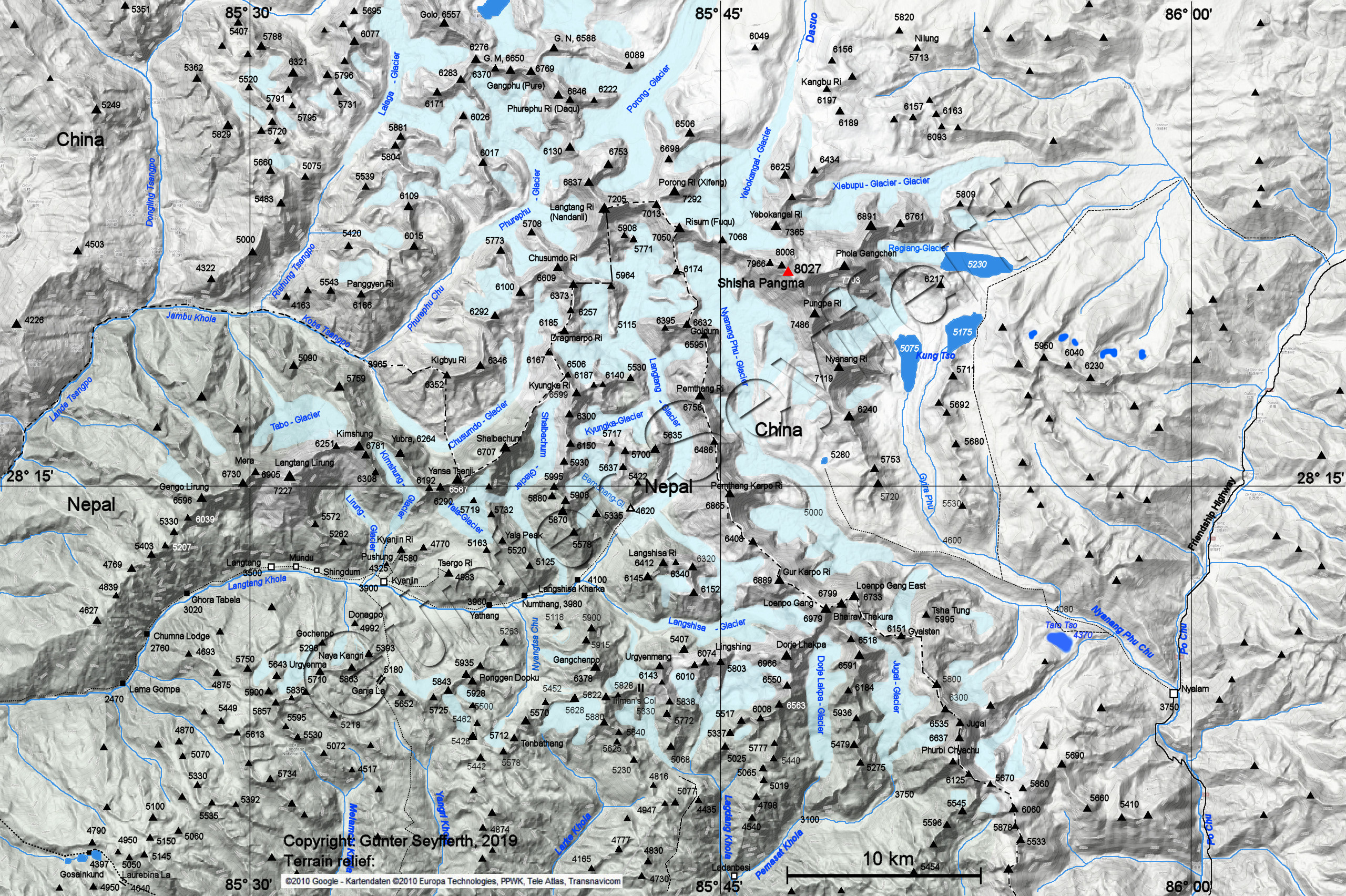
The Langtang Himal (also written Langthang Himal in German texts ) is a mountain range in the Central Himalayas , 65 km north-northeast of Kathmandu , on the border between Nepal and the Autonomous Region of Tibet ( People's Republic of China ).
The Langtang Himal runs north of the Langtang Khola river valley . The highest peak is the 7,227 m high Langtang Lirung . The Nepalese part of the mountains lies within the Langtang National Park . A relatively low panoramic mountain is Yala Peak , a so-called trekking peak . In the east, the higher Jugal Himal joins the eight-thousander Shishapangma . The Chimsedang Lekh mountain range runs south of the Langtang valley .
mountains
The most important peaks of the mountain range from west to east are:
| Surname | Height in m | country |
|---|---|---|
| Langtang II ( Ghengu Liru ) | 6581 | Nepal |
| Langtang Lirung | 7227 | Nepal |
| Kimshung | 6781 | Nepal |
| Kyanjing Ri | 4773 | Nepal |
| Tserko Ri | 5033 | Nepal |
| Yala Peak | 5732 | Nepal |
| Bhemdang Ri ( Morimoto Peak ) | 6150 | Nepal |
| Shalbachum | 6707 | Nepal / People's Republic of China |
| Kyungka Ri | 6979 | Nepal / People's Republic of China |
| Bhemlang Karpu | 5691 | Nepal / People's Republic of China |
| Dragmarpo Ri | 6578 | Nepal |
| Chusmodo | 6508 | Nepal |
| Langtang Ri | 7205 | Nepal / People's Republic of China |