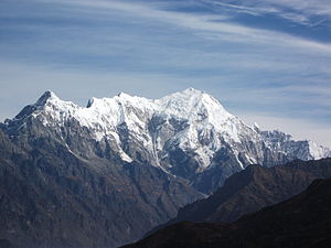
Langtang Lirung
| Langtang Lirung | ||
|---|---|---|
|
View from the southeast: Langtang Lirung on the left, Kimshung on the right |
||
| height | 7227 m | |
| location | District Rasuwa ( Nepal ) | |
| Mountains | Langtang Himal ( Himalaya ) | |
| Dominance | 24.92 km → Porong Ri | |
| Notch height | 1525 m ↓ ( 5702 m ) | |
| Coordinates | 28 ° 15 '21 " N , 85 ° 31' 3" E | |
|
|
||
| First ascent | October 24, 1978 by Seishi Wada and Pemba Tsering | |
|
View from the southwest: Langtang II on the left , Langtang Lirung on the right |
||
The Langtang Lirung (also Langtang I , also written Langthang Lirung in German texts ) is a 7,227 m high mountain in the Langtang region in Nepal near the border with China .
The mountain is located in the Langtang National Park . It is the highest peak in the Langtang Himal , which extends southwest of the eight-thousander Shishapangma . The Lirung Glacier flows into the valley on its eastern flank .
Ascent history
In 1949, Harold William Tilman and Tenzing Norgay were among the first climbers to climb the mountain. In 1978 a Japanese expedition made the first ascent .
On November 9th, 2009, the Slovenian mountaineer Tomaž Humar had an accident while descending the mountain after a solo ascent of the south face.
Web links
- Langtang Lirung on Peakbagger.com (English)


