Langtang
| Langtang लाङटाङ |
||
|---|---|---|
|
|
||
| Coordinates | 28 ° 13 ' N , 85 ° 31' E | |
| Basic data | ||
| Country | Nepal | |
| Bagmati | ||
| ISO 3166-2 | NP-P3 | |
| District | Rasuwa | |
| height | 3455 m | |
| Residents | 415 (2011) | |
|
Kyangjin Gompa
|
||
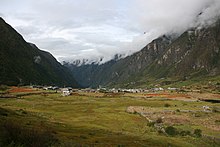
Langtang ( Nepali लाङटाङ , also written Langthang in German-language texts ) is a village, a Village Development Committee (VDC) and a region in Nepal in the north of the Rasuwa district .
The VDC Langtang stretches across the Langtang Khola river valley . In the north it borders on Tibet . The area is protected as a national park . There are numerous very high peaks, for example the Langtang Lirung ( 7246 m ) in Langtang. The park includes a wide range of climatic zones, from subtropical to the nival level. About 25% of the park is forested.
Residents
At the 2011 census, the VDC Langtang had 415 inhabitants (192 of them male) in 152 households. The majority of the inhabitants belong to the Tamang . The village of Langtang was almost completely destroyed by an avalanche of ice and rock triggered by the earthquake in April 2015 and the subsequent pressure wave.
Villages and Hamlets
Langtang consists of several villages and hamlets . The most important are:
![]() Map with all coordinates of the section Villages and Hamlets : OSM
Map with all coordinates of the section Villages and Hamlets : OSM
Climate table
|
Average temperatures for Langtang
Source: thamel.com
|
Web links
Individual evidence
- ↑ National Population and Housing Census 2011 (PDF) Central Bureau of Statistics. Archived from the original on July 31, 2013.
- ↑ Ulrike Putz, Benjamin Schulz: Missing Europeans in Nepal: "The relatives are exhausted with their nerves". In: Der Spiegel . May 5, 2015, accessed November 12, 2017 .
- ^ Matt Hayes: A Valley Rebuilds: The Second Life of Langtang Village. In: Outpost. May 23, 2017, accessed November 12, 2017 .
- ^ District: Rasuwa. List of Settlements (PDF) In: Index of Geographical names of Nepal . National Geographic Information Infrastructure Program. www.ngiip.gov.np. Archived from the original on February 16, 2016. Info: The archive link was automatically inserted and has not yet been checked. Please check the original and archive link according to the instructions and then remove this notice. Retrieved September 5, 2015.
- ↑ CLIMATOLOGICAL DATA FOR SELECTED TREKKING TOWNS on thamel.com


