Queen River
| Queen River | ||
|
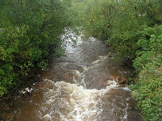
Queen River in Queenstown |
||
| Data | ||
| location | Tasmania ( Australia ) | |
| River system | King River | |
| Drain over | King River → Southern Ocean | |
| source |
Mount Lyell 42 ° 3 ′ 49 ″ S , 145 ° 33 ′ 36 ″ E |
|
| Source height | 164 m | |
| muzzle |
King River near Rinadeena Coordinates: 42 ° 9 ′ 22 ″ S , 145 ° 31 ′ 42 ″ E 42 ° 9 ′ 22 ″ S , 145 ° 31 ′ 42 ″ E |
|
| Mouth height | 64 m | |
| Height difference | 100 m | |
| Bottom slope | 7.8 ‰ | |
| length | 12.9 km | |
| Left tributaries | Princess Creek | |
| Medium-sized cities | Queenstown | |
| Communities | Lynchford, Rinadeena | |
The Queen River is a river in the west of the Australian state of Tasmania .
geography
River course
The river has its source on the southwest slopes of Mount Lyell northeast of Queenstown . From there it flows south, crosses under the Lyell Highway and then crosses the city. About three kilometers east of the settlement Rinadeena and eight kilometers south of Queenstown it flows into the King River .
Tributaries with mouth heights
- Princess Creek - 76 m
Water pollution
For over 80 years, the Queen River had to absorb the overburden from the Mount Lyell Mining and Railway Company's mines and the city's sewage untreated. It is believed that around 100 million tons of spoil were transported into the river in this way, which was then discharged into the lower reaches of the King River and thus led to the formation of a delta in Macquarie Harbor .
A few years ago, the Mount Lyell Remediation and Research and Demonstration Program ensured that catch basins were created for the overburden from the mines, thus reducing the amount of waste and sewage discharged into the river. Today it has a rust-brown color again and is no longer silver-gray as it used to be.
railroad
Part of the route of the old cogwheel railway runs along the river, which was abandoned in the 1960s and has since been rebuilt and is operated as the West Coast Wilderness Railway for tourists.
South of Queenstown is the riverside Lynchford settlement , where a gold mine and other mines operated in the early days of the railroad.
swell
- Geoffrey Blainey: The Peaks of Lyell , 6th Edition, St. David's Park Publishing, Hobart 2000, ISBN 0-7246-2265-9 .
- P. Davies, N. Mitchell and L. Barmuta: The impact of historical mining operations at Mount Lyell on the water quality and biological health of the King and Queen River catchments, western Tasmania . Mount Lyell Remediation Research and Demonstration Program. Supervising Scientist Report 118. Supervising Scientist. Canberra (1996). ISBN 0-642-24317-4
- CV McQuade, JF Johnston and SM Innes: Review of historical literature and data on the sources and quality of effluent from the Mount Lyell lease site Mount Lyell Remediation Research and Demonstration Program. Supervising Scientist Report 104. Supervising Scientist. Canberra. ISBN 0-642-24303-4
- Rae, Lou: The Abt Railway and Railways of the Lyell region . Lou Rae, Sandy Bay 2001, ISBN 0-9592098-7-5 .
- Charles Whitham: Western Tasmania - A land of riches and beauty , Reprint 2003. Edition, Municipality of Queenstown, Queenstown 2003.
Individual evidence
- ↑ a b c d Map of Queen River, TAS . Bonzle.com
- ^ Steve Parish: Australian Touring Atlas . Steve Parish Publishing, Archerfield QLD 2007. ISBN 978-1-74193-232-4 . P. 58
