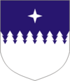
Rägavere
| Rägavere | |||
|
|||
| State : |
|
||
| Circle : |
|
||
| Coordinates : | 59 ° 14 ′ N , 25 ° 48 ′ E | ||
| Area : | 173.74 km² | ||
| Residents : | 993 (01/01/2006) | ||
| Population density : | 6 inhabitants per km² | ||
| Time zone : | EET (UTC + 2) | ||
| Website : | |||

|
|||
Rägavere was a rural municipality in the Estonian district of Lääne-Viru with an area of 173.74 km². It had 993 inhabitants (January 1, 2006).
In addition to the main town Ulvi , the municipality included the villages of Aasuvälja, Kantküla, Kõrma, Lavi, Miila, Mõedaka, Männikvälja, Nurkse, Nõmmise, Põlula , Rägavere, Uljaste and Viru-Kabala.
The community was first mentioned around 1540 and then during the Livonian War . Today the manor house of Rägevere (built around 1780) and a water-powered mill built in 1864 are worth seeing .
Web links
- Website of the municipality of Rägavere (Estonian)

