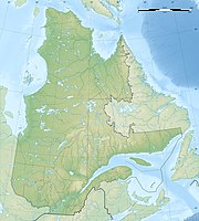
Réserve écologique Louis-Babel
|
Réserve écologique Louis-Babel
|
||
|
View from the east over the impact crater and reservoir. Mont Babel rises to the right of the center of the picture |
||
| location | Manicouagan , Côte-Nord in Québec (Canada) | |
| surface | 235.4 km² | |
| WDPA ID | 23114 | |
| Geographical location | 51 ° 27 ′ N , 68 ° 41 ′ W | |
|
|
||
| Setup date | 1991 | |
| administration | MDDEP | |
The Réserve écologique Louis-Babel is the largest Réserve écologique in the Canadian province of Québec .
It is a protected area established in 1991 on an area of 235.4 km² about 200 km northwest of Sept-Îles . It lies in the county town of Manicouagan , and occupies the northern part of René Levasseur Island in the Manicouagan Reservoir . In the northeast, the reserve borders the Réserve de biodiversité de la Météorite , which is 232.72 km² in size.
It protects the region around the 952 m high Mont Babel , which was named after the Swiss missionary Louis-François Babel (1826–1912) who worked for the Innu and Naskapi . In 1866, 1867, 1868 and 1870 he was the first European to cross the region as far as Labrador. He is therefore considered the first explorer of the northeast of the province of Québec. Mont Babel was formed about 210 million years ago by the impact of a meteorite .
The area protects boreal, low mountain range and alpine forests in the Ecoregion Rivière Toulnustouc , where black spruce , fir and moss predominate, and in the Ecoregion Lac Marceau . Serge Paré described the island in 2003 as the "Cathedral of the Black Spruce" (p. 5), because only in eastern Canada are there such extensive populations of the biotopes dominated by this tree species. These are primarily at risk from the extraction of raw materials, but also continue to be from logging.
In addition, the area is one of the five places in the province that are characterized by shock geological changes, in this case the impact of a meteorite. The resulting crater is the largest and most complex in Canada. Anorthosite , quartz and feldspar are the predominant rocks. There are also semiprecious stones from the zeolite group . During the last ice age the entire mountain was covered by glaciers, which often left a thick layer of tillit .
The René Levasseur Island is very mountainous. The height of the protected area above sea level is between 350 and 940 m . The vegetation changes quickly with the ascent. Forests dominate the lake, which soon give way to crippled trees and crooked wood, then to the tundra.
literature
- Serge Paré: Projets d'aires protégées des monts Groulx et de l'île René-Levasseur. Audiences publiques sur l'environnement , 2003.


