Ecological Réserve de l'Érablière-du-Trente-et-Un-Milles
|
Ecological Réserve de l'Érablière-du-Trente-et-Un-Milles
|
||
| location | La Vallee-de-la-Gatineau , Quebec, Canada | |
| surface | 6.06 km² | |
| WDPA ID | 23107 | |
| Geographical location | 46 ° 9 ' N , 75 ° 51' W | |
|
|
||
| Setup date | 1994 | |
| administration | MDDEP | |
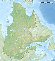
The Réserve écologique de l'Érablière-du-Trente-et-Un-Milles is a protected area established in 1994 on an area of 606 hectares in the southwest of the Canadian province of Québec in the regional county municipality of La Vallée-de-la-Gatineau .
It is located 30 km southwest of the municipality of Maniwaki , west of Matte Bay on the Lac des Trente et Un Milles . It represents and protects the forests typical of the lower Gatineau area or the Lac Simon ecoregion , in which the yellow birch predominates, as well as the eponymous maple forest ( French érablière ). In addition to the sugar maple, one of the northernmost locations of the black sugar maple can be found here .
The reserve is typical of the Upper Laurentides , or this part of the Canadian Shield . The subsoil consists of limestone and dolomite , so there are numerous caves and grottos here. Brown earth , podsol and lithosol, heavily interspersed with rock and stone, describe the soils of the region.
In addition to the yellow birch, there is a species of the hop beech genus ( Ostrya virginiana (Mill.) K. Koch ), as well as red oak ( Quercus rubra ), Weymouth pine and hemlock .
Moose, white-tailed deer , beaver and numerous water birds are the most striking representatives of the local fauna.
The name of the area is derived from the lake of the same name.
Web links
- Réserve écologique de l'Érablière-du-Trente-et-Un-Milles , government site
Remarks
- ↑ Distribution map (PDF, 704 kB).
