
Río Laca Jahuira
| Río Laca Jahuira | ||
|
|
||
| Data | ||
| location | Ladislao Cabrera Province , Bolivia | |
| River system | Río Laca Jahuira | |
| origin |
Poopó Lake 19 ° 10 ′ 59 ″ S , 67 ° 1 ′ 35 ″ W |
|
| Source height | 3686 m | |
| muzzle |
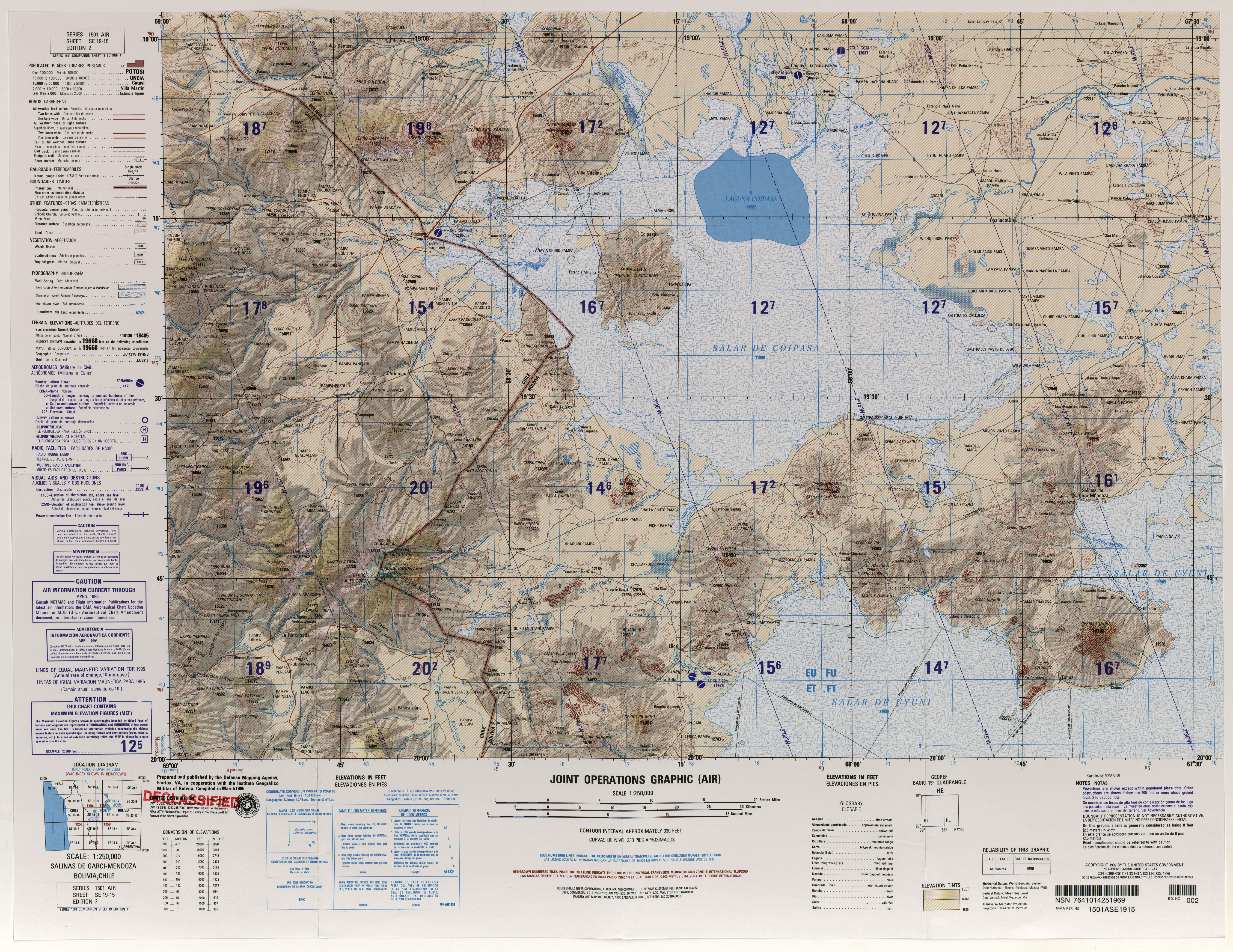
Salar de Coipasa Coordinates: 19 ° 17 ′ 48 ″ S , 67 ° 57 ′ 19 ″ W 19 ° 17 ′ 48 ″ S , 67 ° 57 ′ 19 ″ W. |
|
| Mouth height | 3657 m | |
| Height difference | 29 m | |
| Bottom slope | 0.21 ‰ | |
| length | 135 km | |
| Communities | Pampas Aullagas | |
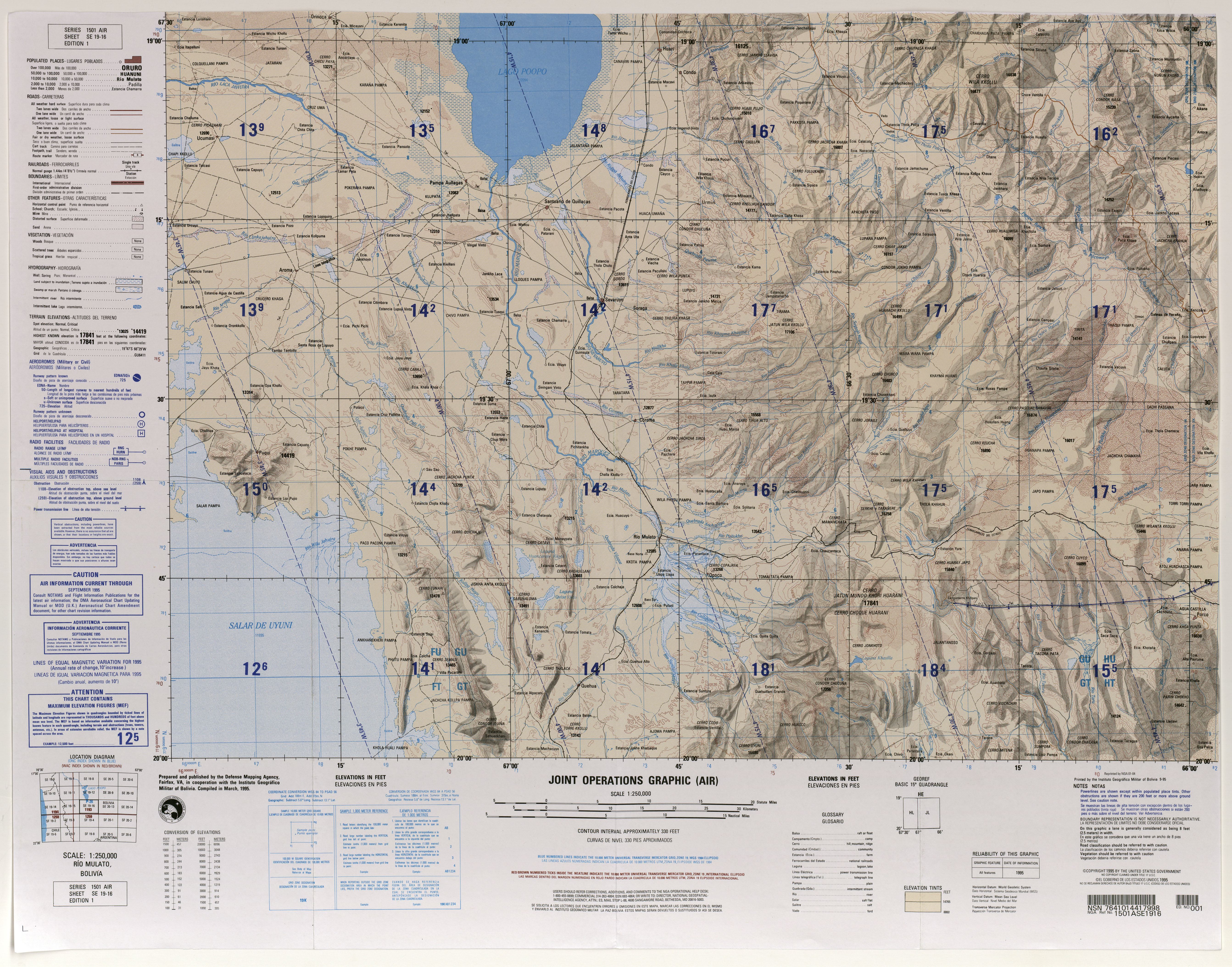
The Río Laca Jahuira ( Aymara : Laq'a Jawira ) is a river in the Ladislao Cabrera province in the Oruro department in the highlands of the South American Andean state of Bolivia .
The Río Laca Jahuira has its origin at an altitude of 3686 m immediately south of Lake Poopó , where it forms in the humid summer months from December to March when the water surface at Lake Poopó reaches its highest level. The water draining from Lake Poopó then flows past the village of Pampa Aullagas in a westerly direction and after 135 kilometers it reaches the Salar de Coipasa salt lake at an altitude of 3,657 m , on whose eastern bank the watercourse seeps away.
In the season with little rainfall, the Río Desaguadero , the main tributary of the Poopósee, delivers less water into the lake than is lost there through evaporation, so that in the dry winter months the water level of the Poopósee gradually falls again by a few meters. During this time, the flow of water to the Río Laca Jahuira is largely interrupted, so that even the Laca Jahuira hardly carries any water during these months.
Web links
- Raised relief map Rio Mulato, Bolivia 1: 100,000 (PDF; 9.2 MB)
- Relief map Salinas de Garci-Mendoza, Bolivia 1: 100,000 (PDF; 8.7 MB)