Río Tacuarembó
| Río Tacuarembó | ||
|
Río Tacuarembó |
||
| Data | ||
| location | Uruguay | |
| River system | Río de la Plata | |
| Drain over | Río Negro → Río Uruguay → Río de la Plata → Atlantic | |
| source | between the Cuchilla de Cuñapirú and the Cuchilla Negra | |
| muzzle | in the Río Negro coordinates: 32 ° 24 ′ 38 ″ S , 55 ° 28 ′ 30 ″ W 32 ° 24 ′ 38 ″ S , 55 ° 28 ′ 30 ″ W.
|
|
| length | 260 km | |
| Catchment area | 14,000 km² | |
The Río Tacuarembó is a river in Uruguay .
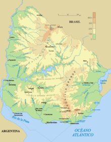
Together with the Río Yí , it is the most important tributary of the Río Negro . Its source is in the north of the Rivera department between the Cuchilla de Cuñapirú and the Cuchilla Negra . From there it runs south through the city of Tranqueras . In the further course it partially forms the border between the Departamentos Rivera and Tacuarembó . After crossing the Tacuarembó department from north to south, it finally flows into the Río Negro as a right-hand tributary at the border with the Durazno department .
Its catchment area covers an area of 14,000 km².
Individual evidence
- ↑ http://www.ine.gub.uy/mapas/departamental/a0h_rivera.pdf Map showing the course of the river on the website of the Instituto Nacional de Estadística de Uruguay
- ^ Enciclopedia Geografica del Uruguay

