Río Tena
| Río Tena | ||
| Data | ||
| location | Province of Napo in Ecuador | |
| River system | Amazon | |
| Drain over | Río Misahuallí → Río Napo → Amazon → Atlantic Ocean | |
| Headwaters |
Cordillera Real 0 ° 52 ′ 23 ″ S , 77 ° 56 ′ 41 ″ W. |
|
| Source height | approx. 1900 m | |
| muzzle |
Río Misahuallí near Tena Coordinates: 0 ° 59 ′ 18 ″ S , 77 ° 48 ′ 19 ″ W 0 ° 59 ′ 18 ″ S , 77 ° 48 ′ 19 ″ W. |
|
| Mouth height | approx. 490 m | |
| Height difference | approx. 1410 m | |
| Bottom slope | approx. 44 ‰ | |
| length | 32 km | |
| Catchment area | approx. 242 km² | |
| Left tributaries | Río Shiti | |
| Right tributaries | Río Colonso, Río Pano | |
| Medium-sized cities | Tena | |
|
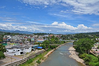
Río Tena immediately below the confluence of the Río Pano |
||
The Río Tena is a 32 km long right tributary of the Río Misahuallí in the province of Napo in Ecuador .
River course
The Río Tena rises in the Cordillera Real at an altitude of about 1900 m . It flows mainly in a south-easterly direction through the mountains and reaches the city of Tena . There the Río Pano meets the Río Tena on the right. This flows another 2 km to the east before it flows into the Río Misahuallí.
Catchment area
The catchment area of the Río Tena covers around 242 km².
Web links
Commons : Río Tena - collection of images, videos and audio files

