Rabbit Island (New Zealand)
| Rabbit Island | |
|---|---|
| Location of Rabbit Island | |
| Waters | Tasman Bay |
| Geographical location | 41 ° 16 '15 " S , 173 ° 8' 51" O |
| length | 8.4 km |
| width | 2 km |
| surface | 15 km² |
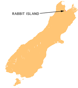
Rabbit Island ( German " Rabbit Island " ) is located in the southernmost part of Tasman Bay on the north side of the South Island of New Zealand . The long, narrow island extends over a length of 8 km in an east-west direction and is 15 km² in size. It is across from the mouth of the Waimea River , seven kilometers west of Richmond .
The island is a resort town for the residents of Motueka , Mapua , Wakefield , Brightwater , Richmond, Nelson, and Stoke . A bridge spans the tidal area between the island and the mainland. After the bridge there is a larger grassy area, after which the beaches begin. The island consists largely of large sand dunes overgrown by pine trees, the roots of which are exposed by hiking the dunes.
annotation
Several islands are called this in New Zealand , but only one of them is more significant. The other Rabbit Islands are smaller than 1 km²:
- west of Kawau Island , north of Auckland ;
- off the east coast of the Coromandel Peninsula at Slipper Island
- south of Riverton in the Foveaux Strait
- north of Tauranga , on the coast in front of Mount Maunganui
- in Lake Wanaka
