Ragged Mountain, New Hampshire
| Ragged Mountain | ||
|---|---|---|
|
Ragged Mountain with Bulkhead as seen from Elbow Pond in Andover |
||
| height | 690 m | |
| location | Merrimack County , New Hampshire , USA | |
| Mountains | Appalachian Mountains | |
| Coordinates | 43 ° 28 '4 " N , 71 ° 49' 54" W | |
|
|
||
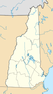
The Ragged Mountain is a mountain zweigipfeliger between Danbury and Andover , Merrimack County , New Hampshire . Its height is 690 meters. It belongs to the Appalachian Mountains , in the narrower sense of the New England highlands , and lies in the catchment area of the Merrimack River , which flows into the Gulf of Maine in Newburyport , Massachusetts . On its north side is a ski area that has existed since 1968 and includes a golf course and a hotel. A hiking trail, the Sunapee-Ragged-Kearsarge Greenway, runs over the summit. In the southeast is the Bulkhead, a granite formation, a nesting place for peregrine falcons . The state road NH 104 is called the Ragged Mountain Highway. It connects Danbury and the ski area to I-93 near New Hampton.
Individual evidence
- ↑ US Geographic Survey [1]
- ↑ Peak excavator [2]
- ↑ [3] New Hampshire Wildlife Action Plan, Appendix A-Birds, page 177, accessed February 5, 2019
- ↑ NH-DOT ( PDF )

