Danbury, New Hampshire
| Danbury | ||
|---|---|---|
 Danbury General Store in Downtown Danbury at the intersection of NH 104 and US 4 |
||
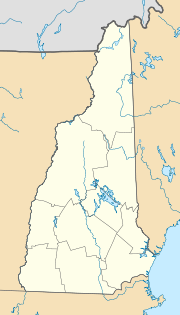
| Location in New Hampshire | ||
|
|
||
| Basic data | ||
| Foundation : | 1795 | |
| State : | United States | |
| State : | New Hampshire | |
| County : | Merrimack County | |
| Coordinates : | 43 ° 32 ′ N , 71 ° 52 ′ W | |
| Time zone : | Eastern ( UTC − 5 / −4 ) | |
| Residents : | 1,196 (as of 2017) | |
| Population density : | 12.2 inhabitants per km 2 | |
| Area : | 98.6 km 2 (approx. 38 mi 2 ) of which 97.9 km 2 (approx. 38 mi 2 ) is land |
|
| Height : | 257 m | |
| Postal code : | 03230 | |
| Area code : | +1 603 | |
| FIPS : | 33-16980 | |
| GNIS ID : | 873574 | |
| Website : | www.townofdanburynh.com | |
Danbury is a town in Merrimack County of New Hampshire in the United States . In 2017, 1196 inhabitants were counted. Danbury includes Elmwood, Fords Crossing, Fords Mill, South Danbury and Converse Station.
history
Danbury was originally a hamlet that politically belonged to the north of Alexandria . Since the places were on different sides of a mountain, which made the way to the settlers' meeting considerably more difficult at the time, a group of local residents asked the state government to divide Alexandria into two localities. The request was granted in 1795 and the southern half was registered as Danbury. Later parts of Wilmot and Hill were added to Danbury. The name goes back to the suggestion of a settler who came from Danbury, Connecticut. That in turn was named after Danbury in England, whose name goes back to a Danish camp in the 11th century.
In 1800 Danbury had 165 residents. In 1847, Danbury was connected to the railway when the railway line was opened by Concord to White River Junction on the Connecticut River.
Administration and municipal institutions
The highest authority of the city administration is three city councilors. The actual city administration also includes an administrative assistant and two law enforcement officers who also act as clerks and tax officials. There is also a finance department with two employees, the road department with one employee and, in a broader sense, the volunteer fire brigade to which a forest fire guard is assigned. Danbury itself has a public library, post office, garbage disposal facility, elementary school and community center, and several churches. The police chief works on a part-time basis and emergency medical care, like the fire department, is on a voluntary basis. The nearest hospital is in New London, 16 miles away.
Economy and Transport
The largest commercial enterprise in Danbury is the ski area on Ragged Mountain , which has several downhill slopes as well as a golf course and accommodation facilities, followed by a manufacturer of prefabricated components for prefabricated houses. There is a small shop with a gas station on site. The nearest shops are in Bristol . After the railway line was closed, Danbury no longer has a connection to the railway. The nearest Amtrak stop is in Claremont . The US 4 runs through Danbury from Portsmouth to New York State, from which the NH 104 state road, the Ragged Mountain Highway, branches off to Bristol and Lake Winnipesaukee in the center of the village . The closest interstate access, I-93 , is 15 miles away. There is a small airfield in Bristol and the nearest scheduled airport is Lebanon Municipal, 27 miles away. The distance to Boston, and thus the nearest intercontinental airport, is 100 miles. The Northern Rail Trail has been laid out on the disused railway line since 1996, a cycle and hiking trail that can also be used as a ski or snowmobile trail in winter.
Personalities
- Julia Krass (* 1997), freestyle skier
Individual evidence
- ^ A b c d New Hampshire Statistics, Location Page
- ^ Danbury Online
- ↑ NH-DOT (PDF; 39 kB)
- ^ [1] Friends Of The Northern Rail Trail
