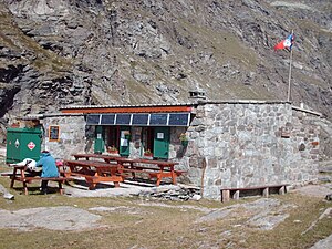
Refuge d'Ambin
| Refuge d'Ambin CAF hut |
||
|---|---|---|
| location | Department of Savoie ; Auvergne-Rhône-Alpes , France ; Valley location: Bramans | |
| Mountain range | Vanoise massif | |
| Geographical location: | 45 ° 9 '50 " N , 6 ° 51' 53.9" E | |
| Altitude | 2270 m | |
|
|
||
| owner | Club Alpin Français Maurienne section | |
| Construction type | hut | |
| Usual opening times | July to August | |
| accommodation | 0 beds, 30 camps | |
The Refuge d'Ambin is a refuge of the Club Alpin Français in France in the commune of Val-Cenis in the Savoie department in the Auvergne-Rhône-Alpes region in the Vanoise massif .
Features and information
The hut is open in July and August. During the spring it is also possible to have a guard if there is a reservation.
Access
To reach this refuge you have to start from the town of Bramans, from the small valley road. It is necessary to take the direction of the hamlet of Le Planay. The road leads to a parking lot about 1.5 km from a bridge on the stretch of this road. Drive towards the hamlet of Planay. The road leads to a parking lot about 1.5 km from a bridge on the stretch of this road. The car park is in a place called Maroqua at an altitude of 1,985 meters.
Ascents
- Pointe Sommeiller ( 3333 m )
- Pointe d'Ambin ( 3266 m )
- Pointe Ferrand ( 3365 m )
- Mont d'Ambin ( 3378 m )
- Grand Cordonnier ( 3086 m )
Transitions
- Refuge de Bramanette ( 2080 m ) from Col de la Coche ( 2947 m )
- Refuge du Petit Mont-Cenis ( 2110 m ) through the Col du Petit Mont-Cenis
- Rifugio Levi Molinari ( 1850 m ) through the Col d'Ambin
- Rifugio Scarfiotti ( 2165 m ) through the Col d'Ambin and the Pointe d'Ambin ( 3266 m )
- Rifugio Luigi Vaccarone ( 2747 m ) through the Col de l'Agnel ( 3091 m )
Special features
There may be times when a camp of soldiers can be seen near the refuge, staying for a night or two during their training.
Web links
- FFCAM.fr: Refuge d'Ambin (French)
- Camptocamp.org: Refuge d'Ambin (French)
- Refuges.info: Refuge d'Ambin (French)
- Skitour.fr: Refuge d'Ambin (French)


