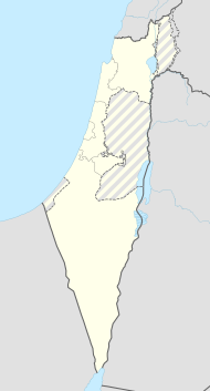
Revadim
| Revadim | ||
|---|---|---|
| Basic data | ||
| hebrew : | רְבָדִים | |
| State : |
|
|
| District : | south | |
| Founded : | February 14, 1947 | |
| Coordinates : | 31 ° 46 ′ N , 34 ° 49 ′ E | |
| Height : | 79 m | |
| Residents : | 766 (as of 2018) | |
| Community code : | 0564 | |
| Time zone : | UTC + 2 | |
| Postal code : | 79820 | |
| Website : | ||
|
|
||
The Kibbutz Revadim ( Hebrew רְבָדִים, German terraces ) is located in the southwest of the Schefela in central Israel . The kibbutz had 766 inhabitants in 2018.
Revadim was founded on February 14, 1947 by members of the Hashomer Hatzair in the Gush Etzion . On May 13, 1948, at the beginning of the War of Independence , the kibbutz was conquered by the Jordanian Arab Legion and soon afterwards annexed by Jordan . After their release from Jordanian captivity, the survivors of the original Revadim founded a new kibbutz of the same name in the young state of Israel on November 28, 1948 . They soon erected a memorial to those who fell in the war.
The important Tel Miqne archaeological site is located on the territory of the kibbutz. The Tel is identified with the Philistine city Ekron , mentioned several times in the Bible. The kibbutz reconstructed part of Ekron and established an archaeological museum, so that tourism became an industry of Revadim.
Web links
- Revadim Homepage (Hebrew)
Individual evidence
- ↑ אוכלוסייה ביישובים 2018 (population of the settlements 2018). (XLSX; 0.13 MB) Israel Central Bureau of Statistics , August 25, 2019, accessed May 11, 2020 .
- ↑ אוכלוסייה ביישובים 2018 (population of the settlements 2018). (XLSX; 0.13 MB) Israel Central Bureau of Statistics , August 25, 2019, accessed May 11, 2020 .
- ↑ Keel, Othmar, Küchler, Max: Places and landscapes of the Bible. A handbook and study travel guide to the Holy Land, Volume 2: The South, Zurich, Einsiedeln, Cologne, Göttingen 1982, p. 829f
- ↑ Revadim-Ekron Museum
