Richter glacier
| Richter glacier | ||
|---|---|---|
|
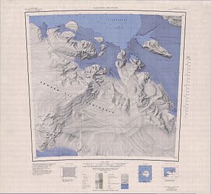
Map of the Edward VII Peninsula with the Richter Glacier (top left) |
||
| location | Marie Byrd Land , West Antarctica | |
| Coordinates | 77 ° 10 ′ S , 155 ° 25 ′ W | |
|
|
||
| drainage | Southern ocean | |
The Richter Glacier is a gently sloping glacier on the Saunders coast of Marie Byrd Land in western Antarctica . On the north side of the Edward VII Peninsula, it flows 16 km west of the Scott Nunatakker from a common saddle with the Butler Glacier in a north-westerly direction and flows into the Southern Ocean in the form of a small glacier tongue . He flows 16
The glacier was used by the Japanese Antarctic expedition to the polar explorer Nobu Shirase in January 1912 as an ascent route to the Scott Nunatakkern. It is recorded for the first time on a map that was created during the Byrd Antarctic Expedition (1928–1930). The United States Geological Survey carried out a more detailed mapping based on its own measurements and aerial photographs of the United States Navy from the years 1959 to 1965. The Advisory Committee on Antarctic Names named him in 1970 after Gregory S. Richter, meteorologist and scientific director of the Byrd station in the Antarctic winter of 1968.
Web links
- Judge Glacier in the Geographic Names Information System of the United States Geological Survey (English)
- Richter Glacier on geographic.org (English)

