Rio (parish)
|
Rio municipality Δημοτική Ενότητα Ρίου (Ρίο) |
||
|---|---|---|
|
|
||
| Basic data | ||
| State : |
|
|
| Region : |
West Greece
|
|
| Regional District : | Achaia | |
| Municipality : | Patras | |
| Geographic coordinates : | 38 ° 18 ' N , 21 ° 47' E | |
| Height above d. M .: | 94 m (average) |
|
| Area : | 97.933 km² | |
| Residents : | 14,034 (2011) | |
| Population density : | 143.3 inhabitants / km² | |
| Code No .: | 370105 | |
| Structure: |
2 city districts 10 local communities |
|
| Website: | www.rion.gov.gr | |
| Located in the municipality of Patras and in the Achaia regional district | ||
Rio ( Greek Ρίο ( n. Sg. )) Has been a municipality of the municipality of Patras in the region of western Greece since 2011 . It emerged from the municipality of the same name and is named after the city of the same name .
location
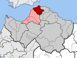
The municipality of Rio occupies an area of 97.933 km² in the north of the Peloponnese and extends from the Gulf of Corinth almost 12 km into the hinterland. It is located between the municipality of Patras in the west and the municipality of Erineos of the municipality of Egialia in the east.
Administrative division
On the occasion of the territorial reform in 1997 , the rural community of Rio was merged with eleven other rural communities to form what was then the municipality of Rio, with the city of Rio as its administrative seat. This municipality was incorporated into the municipality of Patras as one of the five municipal districts during the 2010 administrative reform. The municipality of Rio is subdivided into the two municipalities of Rio and Agios Vasilios as well as twelve local communities, which correspond to the former rural communities.
| District local community |
Greek name | code | Area (km²) | 2001 residents | Residents 2011 | Villages and settlements |
|---|---|---|---|---|---|---|
| Rio | Δημοτική Κοινότητα Ρίου | 37010501 | 3,450 | 5,231 | 4,664 | Rio |
| Agios Vasilios | Δημοτική Κοινότητα Αγίου Βασιλείου | 37010502 | 2,550 | 2,045 | 2,662 | Agios Vasilios |
| Acto | Τοπική Κοινότητα Ακταίου | 37010503 | 1,950 | 917 | 1494 | Acto |
| Ano Kastritsi | Τοπική Κοινότητα Άνω Καστριτσίου | 37010504 | 20.030 | 931 | 832 | Ano Kastritsi |
| Arachovitika | Τοπική Κοινότητα Αραχοβιτίκων | 37010505 | 1.275 | 743 | 902 | Arachovitika, Kato Arachovitika |
| Argyra | Τοπική Κοινότητα Αργυράς | 37010506 | 16.008 | 370 | 288 | Argyra |
| Drepano | Τοπική Κοινότητα Δρεπάνου | 37010507 | 5.525 | 557 | 541 | Drepano |
| Kato Kastritsi | Τοπική Κοινότητα Κοινότητα Κάτω Καστριτσίου | 37010508 | 7.379 | 712 | 1046 | Kato Kastritsi, Magoula |
| Pititsa | Τοπική Κοινότητα Πιτίτσης | 37010509 | 23.684 | 82 | 26th | Pititsa |
| Platani | Τοπική Κοινότητα Πλατανίου | 37010510 | 5.878 | 460 | 481 | Platani |
| Sella | Τοπική Κοινότητα Σελλών | 37010511 | 7.454 | 388 | 302 | Sella |
| Psathopyrgos | Τοπική Κοινότητα Ψαθοπύργου | 37010512 | 3,800 | 834 | 796 | Psathopyrgos, Kato Rodini |
| total | 370105 | 98.983 | 13,270 | 14,034 | ||
Individual evidence
- ↑ Results of the 2011 census at the National Statistical Service of Greece (ΕΛ.ΣΤΑΤ) ( Memento from June 27, 2015 in the Internet Archive ) (Excel document, 2.6 MB)
- ↑ Κεντρική Ένωση Δήμων και Κοινοτήτων Ελλάδας (ΚΕΔΚΕ) Ελληνική Εταιρία Τοπικής Ανάπτυξης και Αυτοδιοίκησης (ΕΕΤΑΑ) (ed.): Λεξικό Διοικητικών Μεταβολών των Δήμων και Κοινοτήτων (1912-2001). 2 (Τόμος Β, λ – ω), Athens 2002, ISBN 960-7509-47-1 , p. 384.

