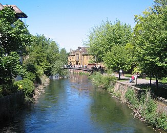
River Avon (English Channel)
| Avon | ||
|
The Avon at Salisbury |
||
| Data | ||
| location | England ( Wiltshire , Hampshire , Dorset ) | |
| River system | River Avon | |
| River basin district | South east | |
| origin | Confluence of the Eastern and Western Avon north of Upavon 51 ° 18 ′ 9 ″ N , 1 ° 48 ′ 36 ″ W |
|
| muzzle | in Christchurch in the English Channel Coordinates: 50 ° 43 ′ 26 " N , 1 ° 44 ′ 30" W 50 ° 43 ′ 26 " N , 1 ° 44 ′ 30" W
|
|
| length | 96 km | |
| Medium-sized cities | Salisbury , Christchurch | |
| Small towns | Amesbury , Fordingbridge , Ringwood | |
| Ports | Christchurch Harbor | |
The River Avon [ ˈeɪvən ] ( British avon "river") is an approximately 96 km long river in the south of England in the county of Hampshire .
course
The River Avon has its source near Devizes in the county of Wiltshire , flows through Amesbury , Salisbury , Fordingbridge and Ringwood and flows into the English Channel in Christchurch in the county of Dorset .
The River Avon manages a height difference of around 150 m. Tributaries include the River Bourne , River Wylye, and River Stour . The river is no longer navigable today; in the 17th century it was expanded to a stretch of 58 km between Salisbury and Christchurch and was opened to shipping in 1684. In the 18th century, however, the traffic decreased; in addition, repeated floods destroyed the expansion work.
