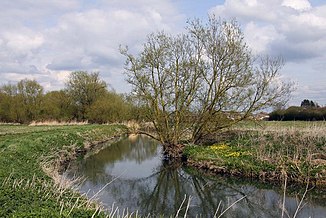
River Ock (Thames)
| River Ock | ||
|
The River Ock |
||
| Data | ||
| location | Oxfordshire , England | |
| River system | Thames | |
| Drain over | Thames → North Sea | |
| source | south of Little Coxwell 51 ° 37 ′ 35 " N , 1 ° 35 ′ 23" W |
|
| muzzle | in Abingdon on the Thames Coordinates: 51 ° 39 ′ 56 " N , 1 ° 17 ′ 6" W 51 ° 39 ′ 56 " N , 1 ° 17 ′ 6" W
|
|
| Left tributaries | Hollywell Brook , Sandford Brook | |
| Right tributaries |
Stutfield Brook , Nor Brook , Childrey Brook , Land Brook |
|
| Medium-sized cities | Abingdon | |
| Communities |
Longcot , Stanford in the Vale , Charney Bassett , Lyford , Garford , |
|
The River Ock is a watercourse in Oxfordshire , England . It is being built south of Little Coxwell . It first flows south and passes Longcot in the west. South of this place it turns in an easterly direction, in which it flows to its confluence with the Thames at Abingdon .
Web links
Commons : River Ock - collection of images, videos and audio files
