Riverview (New Brunswick)
| Riverview | ||
|---|---|---|
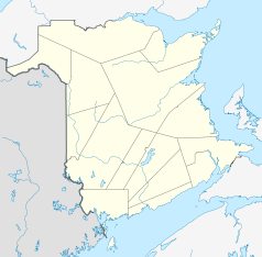
| Location in New Brunswick | ||
|
|
||
| State : |
|
|
| Province : | New Brunswick | |
| County: | Albert County | |
| Coordinates : | 46 ° 4 ′ N , 64 ° 48 ′ W | |
| Height : | 20 m | |
| Area : | 33.88 km² | |
| Residents : | 19,128 (as of 2011) | |
| Population density : | 564.6 inhabitants / km² | |
| Time zone : | Atlantic Time ( UTC − 4 ) | |
| Postal code : | E1B | |
| Area code : | +1 506 | |
| Mayor : | Ann Seamans | |
| Website : | www.townofriverview.ca/en/ | |
 panorama |
||
Riverview is a city in Albert County in the Canadian province of New Brunswick with 19,128 inhabitants (as of 2011).
geography
Riverview is on the south bank of the Petitcodiac River . Moncton joins on the north bank of the river. The connecting roads New Brunswick Route 112 and New Brunswick Route 114 meet in Riverview.
history
The first settlers in the area came from Yorkshire in 1733 . The city was founded in 1973 after the villages of Bridgedale , Gunningsville and Riverview Heights merged . The name Riverview (river view) came about almost inevitably due to its location on the Petitcodiac River. The city supports the nearby and much larger Moncton with suppliers and serves as a quiet residential area. A specialty of Riverview is the production of maple syrup and maple sugar . The traditional Maple Sugar Festival is celebrated in April each year towards the end of the maple syrup season .
sons and daughters of the town
- Brett Lutes , ice hockey player
Individual evidence
- ↑ Statistics Canada - Census Riverview, New Brunswick 2011
- ↑ tourismnewbrunswick Maple Sugar Festival
Web links
- history-of-riverview - History
