Rivière Sainte-Anne (du Nord)
| Rivière Sainte-Anne | ||
| Data | ||
| location | Capitale-Nationale in Québec (Canada) | |
| River system | Saint Lawrence River | |
| Drain over | Saint Lawrence River → Atlantic Ocean | |
| origin |
Lac Sainte-Anne du Nord 47 ° 41 ′ 7 ″ N , 70 ° 44 ′ 14 ″ W |
|
| Source height | 914 m | |
| muzzle | in the St. Lawrence River near Sainte-Anne-de-Beaupré Coordinates: 47 ° 2 ′ 20 ″ N , 70 ° 53 ′ 0 ″ W 47 ° 2 ′ 20 ″ N , 70 ° 53 ′ 0 ″ W |
|
| Mouth height | 0 m | |
| Height difference | 914 m | |
| Bottom slope | 9.4 ‰ | |
| length | 97 km | |
| Catchment area | 1077 km² | |
| Drain |
MQ |
26 m³ / s |
| Small towns | Sainte-Anne-de-Beaupré | |
|
Canyon Sainte-Anne |
||
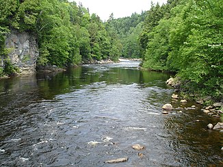
The Rivière Sainte-Anne (formerly: Rivière Sainte-Anne du Nord ) is a river in the Capitale-Nationale administrative region of the Canadian province of Québec .
It has a length of 97 km, a catchment area of 1077 km² and an average discharge of 26 m³ / s. The river has its origin in the Lac Sainte-Anne du Nord . From there it flows in a southerly direction and flows into the Saint Lawrence River at Sainte-Anne-de-Beaupré opposite the island of Île d'Orléans and 35 km northeast of the provincial capital Québec .
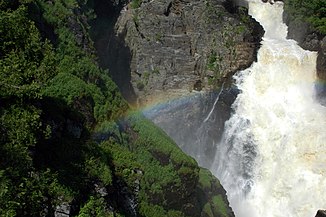
At Saint-Ferréol-les-Neiges there are the Sept Chutes waterfalls , which in several cases pour over a height difference of 128 m. The river then flows through the 10 km long Canyon Sainte-Anne gorge . At its end near Saint-Joachim is the 74 m high Chute Sainte-Anne waterfall .
Hydroelectric power plant
The Sept Chutes hydropower plant operated by Hydro-Québec is located on the Rivière Sainte-Anne. It was built in 1916 and modernized in 1999. It has four turbines with a total output of 22 MW . The hydraulic potential is 124.97 m. The power plant can be visited.
Web links
Individual evidence
- ↑ a b c Bureau Brille publiques sur l'environnement (PDF; 103 kB)
- ^ Hydro-Québec - Hydroelectric Generating Stations

