Rockwood (Tennessee)
| Rockwood | ||
|---|---|---|
| Nickname : Rockvegas | ||
 Rockwood Municipal Building |
||
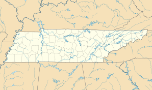
| Location in Tennessee | ||
|
|
||
| Basic data | ||
| Foundation : | 1860 | |
| State : | United States | |
| State : | Tennessee | |
| County : | Roane County | |
| Coordinates : | 35 ° 52 ′ N , 84 ° 41 ′ W | |
| Time zone : | Eastern ( UTC − 5 / −4 ) | |
| Residents : | 5,700 (as of July 2000) | |
| Population density : | 20.2 inhabitants per km 2 | |
| Area : | 282.4 km 2 (approx. 109 mi 2 ) of which 282.3 km 2 (approx. 109 mi 2 ) are land |
|
| Height : | 272 m | |
| Postal code : | 37854 | |
| FIPS : | 47-64440 | |
| GNIS ID : | 1299838 | |
| Website : | www.rockwoodtn.org | |
| Mayor : | Mike Miller | |
Rockwood is a small town in the east of the US state Tennessee . The population census of 2000 produced almost 5700 residents. Rockwood was built in the late 1860s as the headquarters of the Roane Iron Company on Cherokee Land. The suggestion for this came from the then General William T. Wilder, the place was named after William O. Rockwood , the company's first president.
geography
Rockwood is on the eastern edge of the Cumberland Plateau , where it merges into the Crab Orchard Mountains. The western border of the municipality is also the border between Eastern Time Zone and Central Time Zone (see time zone # zone time UTC − 5h to UTC − 4h ). Much of the southern border is formed by the Tennessee River. There the river was dammed to Watts Bar Lake - reservoir .
Web links
- Official website of Rockwood Township ( English )
