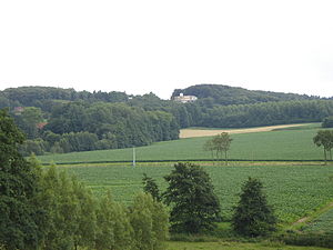
Rodeberg (Belgium)
| Rodeberg | ||
|---|---|---|
|
Rodeberg |
||
| height | 143 m above sea level NHN | |
| location | West Flanders , Belgium | |
| Mountains | Heuvelland | |
| Coordinates | 50 ° 47 '2 " N , 2 ° 45' 23" E | |
|
|
||
The 143 m high Rodeberg is a mountain near the village of Westouter in the Belgian province of West Flanders . Geologically, it is a so-called witness mountain . The Rodeberg and Mont Noir are connected by a cable car . The Hellegatbos (French: Hellegat Bois) is located on the northern and western flanks of the mountain. This is a forest area that serves as a nature and hiking area. The name of the forest Hellegat refers to a deep gorge on the Rodeberg, which is known as the hole to hell (Helle means hell , translated into German, and Gat means hole, so hell hole).
The name of the mountain is derived from the Dutch word "clearing", which means clearing or deforestation and refers to the first deforestation on the mountain in the 10th and 11th centuries. A second deforestation of the mountain took place during the First World War due to heavy artillery fire. After the war, the forest was reforested.
geography
The Rodeberg is part of the so-called Mittelsteges within the range of hills of the Heuvelland. This range of hills also includes the Watenberg , Kasselberg, Wouwenberg, Katsenberg , Boeschepeberg , Kokereelberg , Mont Noir , Vidaigneberg , Baneberg , Sulferberg , Goeberg , Monteberg and Kemmelberg . To the south of this ridge is the Leie basin , to the north of this ridge is the catchment area of the river IJzer .
Bike races
The route across the Rodeberg has often been on the route of various well-known cycling competitions in the region.
Individual evidence
- ↑ Omer Vandeputte: Gids Voor Vlaanderen, Lannoo Uitgeverij, 2007, p. 547 online at Google Books
- ↑ John Rijpens: filmpjes Vlaamse: troetelkind of kindje ondergeschoven? : waar Vlaamse jeugdauteurs het schrijven leerden, Asp / Vubpress / Upa, 2010, p. 163 online at Google Books
- ^ Sven-Claude Bettinger: Belgium: (with a large travel map), Baedeker, 2013, p. 334 online at Google Books
- ↑ Cartes topographiques Belgique: 1: 50,000, Institut géographique national (Belgique). Lannoo Uitgeverij, 2005, p. 381 online at Google Books
- ↑ Marcel Gevaert: Op Stap in de Grensstreek Va, Lannoo Uitgeverij, 2006, p. 84 online at Google Books
- ↑ a b Westouter , erfgoedhaltes.be
- ↑ Peter Cuypers: Flandern, Lannoo Uitgeverij, 1989, p. 25 online at Google Books
- ↑ Werner Müller-Schell: Classic Cycle Routes of Europe: The 25 Greatest Road Cycling Races and how to Ride Them, A&C Black, 2012, p. 40 online at Google Books
- ↑ 75e editie Kattekoers open Topcompetitie , Het Laatste Nieuws , March 13, 2015
- ↑ Wereldkampioen Jasper Stuyven topt het deelnemersveld in Ieper , Het Nieuwsblad , March 14, 2010

