Roseires Dam
| Roseires Dam | |||||||||
|---|---|---|---|---|---|---|---|---|---|
|
|||||||||
|
|
|||||||||
| Coordinates | 11 ° 47 '59 " N , 34 ° 23' 19" E | ||||||||
| Data on the structure | |||||||||
| Construction time: | ? –1966 /? –2013 | ||||||||
| Height of the barrier structure : | 78 m | ||||||||
| Height of the structure crown: | 490 m | ||||||||
| Crown length: | 24 410 m | ||||||||
| Power plant output: | 1,800 MW | ||||||||
| Data on the reservoir | |||||||||
| Water surface | 290 km² | ||||||||
| Reservoir length | 55 km | ||||||||
| Reservoir width | 9 km | ||||||||
| Storage space | 7040 million m³ | ||||||||
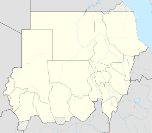
The Roseires Dam ( Arabic خزان الروصيرص) dams the Blue Nile in the state of an-Nil al-azraq in Sudan .
location
The Roseires Dam is the first Sudanese dam in the Blue Nile below the Ethiopian-Sudanese border. Its reservoir extends over a length of about 55 km in a north-south direction with a width of 9 km near the city of ad-Damazin .
history
The idea of the Roseires Dam goes back to a study commissioned by the British colonial administration in the 1950s, in which the engineering firm Sir Alexander Gibb and Partners proposed that a drainage project called the Kenana Scheme be constructed in the south of the Gezira project in a comparable size and with Help to irrigate a Roseires dam. Sudan, which became independent in 1956, was initially unable to finance the project. It was only after Sudan had signed the 1959 agreement with Egypt on the use of the water of the Nile that the Roseires Dam was built with a loan from the World Bank and West Germany and was completed in 1966.
The Kenana project was now considered too expensive. The water from the Roseires reservoir was therefore used for the improved irrigation of the Gezira project and for its al-Managil expansion and later for the new Rahad project on the right side of the river.
Since the reservoir, like the Khashm-el-Girba reservoir on the Atbara , had lost a large part of its volume through sedimentation , the crown of the Roseires Dam was increased by 10 m. This work was completed in February 2013.
Building
The Roseires dam is an approximately 1000 m wide pier dam , which is enclosed by two earthwork dams . The dam wall, completed in 1966, originally had a height of 68 m, the dam crest was 13.5 km long. The dam wall has 5 bottom drains with 6 m wide and 10.5 m high gates.
In 1971 the dam was equipped with 7 turbines to generate electricity.
It is estimated that the Blue Nile transported a sediment load of 140 million tons into the reservoir each year and that the original storage volume of 3,300 million m³ was reduced by 900 million m³ by 1995. The reservoir is therefore emptied via the bottom outlet once a year when the tide rises in order to flush out as much sediment as possible.
When the crown was raised by 10 m in 2013, the dam became a total of 24,410 m long. The power plant output was also increased to 1,800 MW. The work was funded by Kuwait , Saudi Arabia and other Arab countries and carried out by the China International Water & Electric Corporation .
See also
- List of power plants in Sudan
- List of dams in the world (Sudan)
- List of dams on the Nile
- List of bridges over the Nile
- List of the largest dams on earth
- List of the largest reservoirs on earth
Individual evidence
- ^ Bret Wallach: Irrigation in Sudan since Independence. 2004 revised but not updated version compared to the version in The Geographical Review , 74: 2, April 1984, pp. 127-144
- ↑ Ahmed Saleh (Coordinator): Assessment of the current state of the Nile Basin Reservoir Sedimentation Scheme. ( Memento of October 9, 2010 in the Internet Archive ) Nile Basin Capacity Building Network 'NBCBN', 2005, pp. 9-12
- ↑ Eyasu Yazew Hagos: Development and Management of Irrigated Lands in Tigray, Ethiopia Dissertation 2005, Delft. P. 43/61 f
- ↑ Africa Dams Briefing 2010 - International River sp. 54 (PDF; 308 kB).
- ↑ Sudan completes expansion of 1,800-MW Roseiris hydropower project. ( Memento from March 1, 2014 in the Internet Archive ) Article from February 1, 2013 on HydroWorld.com


