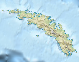
Ross Pass
| Ross Pass | |||
|---|---|---|---|
| Compass direction | West ( Brøgger Glacier ) | East ( Ross Glacier ) | |
| Pass height | 610 m | ||
| location | South Georgia | ||
| map | |||
|
|
|||
| Coordinates | 54 ° 32 '58 " S , 36 ° 15' 57" W | ||
The Ross Pass is a narrow mountain pass on South Georgia in the South Atlantic . It connects the southeast end of the Allardyce Range with the northwest end of the Salvesen Range . The pass runs at an altitude of 610 m and provides a passage for dog sledding from Ross Glacier to Brøgger Glacier .
A German research group mapped the pass in the course of the First International Polar Year (1882–1883) and profanely named it the Gletscherjoch . The South Georgia Survey took to own surveys from 1951 to 1952 to change this designation based on the designation of the same name, the nearby glacier front. Both sides are named after the British polar explorer James Clark Ross (1800–1862).
Web links
- Ross pass the Geographic Names Information System of the United States Geological Survey (English)
- Ross Pass on geographic.org (English)
