Rothenbachkopf
| Rothenbachkopf | ||
|---|---|---|
|
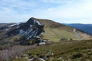
Rothenbachkopf from the north |
||
| height | 1315 m | |
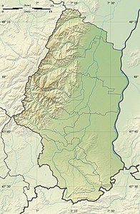
| location | Haut-Rhin , Grand Est , France | |
| Mountains | Vosges | |
| Coordinates | 48 ° 0 '4 " N , 6 ° 58' 50" E | |
|
|
||
The Rothenbachkopf is a 1315 m high mountain in the High Vosges . Just a few meters west of the summit, the Route des Crêtes runs south from the Col de la Schlucht . Hiking trails run by the Vosges Club lead over the summit . A few km north of the Rothenbachkopf, the border between Alsace and Lorraine turns to SW.
Map base
Cartes IGN 31 (Série verte): St-Dié - Mulhouse - Bâle, 1: 100,000, Edition 8, Institut Géographique Nationale, Paris 1990
Web links
Commons : Rothenbachkopf - Collection of images, videos and audio files

