Runcorn
Coordinates: 53 ° 20 ′ N , 2 ° 44 ′ W
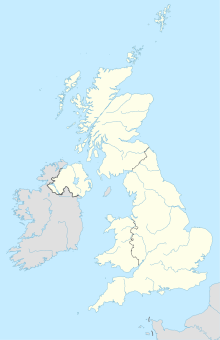
Runcorn is an industrial town in the Unitary Authority Halton in England and is located on the south side of the River Mersey and the Manchester Ship Canal that runs next to it about 20 kilometers east of Liverpool . It has 61,330 inhabitants (as of 2001).
The name of the city is derived from the time of the Saxons ; the settlement was called Rumcofan . The ruler of the Kingdom of Mercia , Aethelflead (872-918), built a fortress in Runcorn to protect the northern border of the kingdom from the Vikings . The first written mention of Runcorn refers to the visit of Aethelflead in the year 915. However, Runcorn is not listed in the Domesday Book of 1086, although the neighboring towns of Halton, Weston, Aston, Sutton and Stockham are mentioned. Either Runcorn was part of Halton at the time or it was deemed too insignificant to be included in the Domesday Book.
At the time of the Normans , Hugh d'Avranches , the Earl of Chester , divided his territory into baronies. The Halton barony received rule over the other baronies. The first Baron of Runcorn, Nigel, built a motte (tower hill castle) on Halton Hill in 1071 . From Halton Castle today only one is ruined condition.
In 1115 the son of Baron Nigel, William Fitznigel, founded an Augustinian priory in Runcorn. This was moved in 1134 to Norton, about 6 km from Runcorn. The Barons of Halton financially supported the priory until 1200. In 1391 she was elevated to the status of an abbey. In 1536 the monastery was abandoned and sold a few years later. Today the abbey is one of the most important sights of Runcorn, along with Halton Castle.
Today the ruins of the Elizabethan country estate Rocksavage also belong to Runcorn .
During the English Civil War the castle was in the hands of the monarchists, led by Earl Rivers, the Steward of Halton. It fell into the hands of parliamentarians twice (1643 and 1644).
During the Second World War , Runcorn was a center of British chemical weapons production . The most important mustard gas factory in the country was located here, where hundreds of tons of the warfare agent were stored. Phosgene was produced at the nearby Rocksavage works . Since there was a risk that poison gas could have escaped from damaged storage containers during German air strikes, gas masks were issued to the population.
Today, Runcorn consists of the old town , which emerged during the industrial revolution , and the new town , which was built in the 1970s and 1980s.
Runcorn is located at Runcorn Gap , a narrow part of River Mersey, which for the crossing through the Runcorn Railway Bridge and the defunct Transporter Bridge Runcorn and replacing it the Silver Jubilee Bridge was used. The Mersey Gateway Bridge has been part of a bypass road that avoids the town centers since 2017 .
At Runcorn lies the village of Daresbury, where Lewis Carroll was born. There is a window in the church there that shows some figures from Alice in Wonderland.
Web links
Individual evidence
- ↑ Robert Harris , Jeremy Paxman: The silent death - The history of biological and chemical weapons , Heyne Verlag , 2002, p. 183
