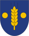
Sõmeru
| Sõmeru | |||
|
|||
| State : |
|
||
| Circle : |
|
||
| Coordinates : | 59 ° 22 ′ N , 26 ° 26 ′ E | ||
| Area : | 168.29 km² | ||
| Residents : | 3,885 (01/01/2006) | ||
| Population density : | 23 inhabitants per km² | ||
| Time zone : | EET (UTC + 2) | ||
| Postal address : | Kooli 2 44201 Sõmeru |
||
| Website : | |||

|
|||
Sõmeru (German: Neu-Sommerhusen ) was a rural community in the Estonian district of Lääne-Viru with an area of 168.29 km². It had 3885 inhabitants (January 1, 2006). Sõmeru was about 5 km from Rakvere .
In addition to the main town Sõmeru (1312 inhabitants), the municipality also included the villages of Aluvere, Andja , Aresi, Jäätma, Kaarli, Katela, Katku, Kohala, Kohala-Eesküla, Koovälja, Muru, Nurme, Näpi, Papiaru, Rahkla, Raudlepa, Raudvere, Roodevälja , Rägavere, Sooaluse, Sämi, Sämi-Tagaküla, Toomla, Ubja, Uhtna, Ussimäe, Vaeküla, Varudi-Altküla, Varudi-Vanaküla and Võhma.
Web links
- Sõmeru Municipality website (Estonian)

