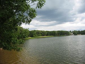
Saadjärv
| Saadjärv | ||
|---|---|---|

|
||
| The Estonian lake Saadjärv | ||
| Geographical location | Estonia | |
| Drain | Mudajõgi | |
| Places on the shore | Tabivere | |
| Location close to the shore | Tartu | |
| Data | ||
| Coordinates | 58 ° 32 '0 " N , 26 ° 40' 0" E | |
|
|
||
| surface | 7.8 km² | |
| length | 6 km | |
| width | 1.8 km | |
| Maximum depth | 25 m | |
| Middle deep | 8 m | |
The Saadjärv is a lake in Estonia .
Saadjärv is located on the border of the Tartu and Jõgeva counties , about 15 km from the city of Tartu in the towns of Tabivere and Äksi . The lake is 53.4 m above sea level. Its area is 7.80 km². Its length is 6 km, its maximum width 1.8 km. The deepest point of Saadjärv is 25 m. Its average depth is 8 m. The only outflow of the Saadjärv is the Mudajõgi .
The lake is part of the Vooremaa Protected Landscape Area. The lake is extremely rich in fish (including roach , whitefish , pike , eel , ruff and bleak ). In 1907, the naturalist Nikolai Samsonow from the University of Tartu on the lake founded Estonia's first biological station .
Web links
Commons : Saadjärv - collection of images, videos and audio files
- Full description (Estonian)
