Salvatierra (Guanajuato)
| Salvatierra | ||
|---|---|---|
|
Coordinates: 20 ° 13 ′ N , 100 ° 53 ′ W Salvatierra on the map of Guanajuato
|
||
| Basic data | ||
| Country | Mexico | |
| State | Guanajuato | |
| Municipio | Salvatierra | |
| City foundation | 1644 | |
| Residents | 37,203 (2010) | |
| Detailed data | ||
| surface | 12.2 km 2 | |
| Population density | 3,049 inhabitants / km 2 | |
| height | 1750 m | |
| Post Code | 38900 | |
| Website | ||
| Salvatierra - town center with Iglesia de Nuestra Santísima Madre de la Luz | ||
| Salvatierra - former Santo Domingo monastery church | ||
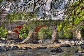
| Puente de Batanes | ||
Salvatierra is a city with around 40,000 inhabitants and the capital of a municipality ( municipio ) with around 100,000 inhabitants in the south of the Mexican state of Hidalgo . Because of its colonial center and the charming landscape, the place has been one of the Pueblos Mágicos of the country since 2012 .
Location and climate
The city of Salvatierra is located on the Río Lerma in a valley surrounded by mountains about 270 km (driving distance) northwest of Mexico City at an altitude of about 1750 m . Guanajuato , the state capital, is just 145 km northwest. The city's climate is described as steppe-like; the overall rather sparse rain (approx. 615 mm / year) falls mostly in the summer half-year.
population
| year | 2000 | 2005 | 2010 |
| Residents | 34,066 | 36,306 | 37.203 |
The inhabitants of the city are mostly of Indian descent; the proportion of mestizos is also relatively high. Only a small part of the community's residents speak the regional Nahuatl dialect; Colloquial language is usually Spanish.
economy
Well supplied with water by the nearby Lerma river , the region around Salvatierra became an important center for agricultural products of all kinds; Livestock breeding also plays an important role. In addition to the food industry (dairy products), the textile industry is of primary importance. There are several large landowners (hacienderos) in the municipality .
history
Before the arrival of the Spaniards, the area was called Guatzindeo (= "fertile place"). In 1644, the place, now called San Andrés de Salvatierra , received city rights (villa) from the viceroy García Sarmiento de Sotomayor . In 1813 25 insurgents were at the Bridge of Batanes (insurgentes) shot.
Attractions
- The Templo del Carmen , built almost entirely from rubble stones, belonged to a Carmelite convent and is the oldest building in the city (1644–1655).
- The Iglesia de Nuestra Señora de la Luz , begun in 1744, shows a typical Mexican baroque facade with a central portal zone and two side bell towers (campanarios) as can also be seen at the Church of Santa Prisca in Taxco and elsewhere. While the lower part of the towers is unstructured and unadorned, the actual tower floors are richly structured. The interior of the church nowadays has a classical appearance.
- The church of the former Dominican monastery (Santo Domingo) is located in the south of the city. It has a similar structure to the Iglesia de Nuestra Señora de la Luz , but has only one tower. The former cemetery with its beautiful tombs is largely destroyed.
- Surroundings
- The Hacienda de San José del Carmen , which in its current state dates from the 19th and early 20th centuries, is one of the most beautiful in the area.
Web links
- Salvatierra - Photos + Info (inafed, Spanish)
- Salvatierra, sights - photos + information (Spanish)


