Salt axes
Coordinates: 47 ° 50 ' N , 13 ° 1' E
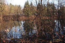
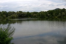
The salt axes in the north of the Austrian capital Salzburg in the Liefering district are a series of smaller artificial stagnant bodies of water not far from the left bank of the Salzach , which were essentially created as quarry ponds around and after 1940. The former sole Salzachsee was separated into two parts when it was designed as a local recreation area after 1967, namely the part in the north , which is often seen as the actual Salzachsee (officially known as the Großer Salzachsee ) and the smaller bird lake in the south. In the course of the dredging activities at the time, the Karlsbader Weiher and, after the Second World War, the Lieferinger bathing lake and some other smaller bodies of water were created. The salt axes and their immediate surroundings are part of a local recreation area and are located in the Salzachsee-Saalachspitz nature reserve . The lakes are also namesake for the adjacent salt axis settlement . In everyday parlance, the Salzachsee is generally understood to mean the location in general, often including the Liefering bathing lake.
history
For the history of the salt axis area, see the Salzachsee-Saalachspitz conservation area .
The Salzachsee is - like all the nearest bodies of water - a quarry pond, created from 1938 with the excavation of earth material for the construction of the former Reichsautobahn to Vienna , which was started but initially remained unfinished . After the area was temporarily used as a landfill, the area was gradually cultivated and has been a protected landscape area since 1967 . The southernmost of all today's lakes, the Vogelsee, was to become part of an urban bird sanctuary after the establishment of the local recreation area, according to the wishes of earlier nature conservation specialists in the Salzburg City Council and was then also home and breeding ground for rare bird species. The “bird sanctuary” there, which had also been included in “Zinner's city maps” for decades, was never legally implemented. The “Blauer Kreis” animal welfare association at the time was also involved in the planning.
Soon after its creation, the name Salzachsee only emerged as a temporary solution, but it then lasted.
“In the meantime we have called the lake 'Salzach Lake'. It is very close to the Salzach, and there is not just a spatial, but also an 'inner' connection: due to the same water level, because the groundwater level is based on the water level of the Salzach. For the time being, however, the lake could also be called the Reichsautobahn lake, until a poetic name is found. "
The Karlsbader Weiher got its name after the Czech city of Karlsbad , from where many refugees came to Salzburg after the Second World War .
Location and the individual waters
The salt axes are located on a gravel plain in the north-northwest of the city of Salzburg to the left of the Salzach beyond a narrow belt of alluvial forests at 408 m above sea level. A. , the allotment pond at 405 m.
The name for the entire narrow area there is the Salzachsee, which has been divided into two parts since around 1967, today with the official names Großer Salzachsee for the northern part and Vogelsee for the southern part.The northern lake also has other local names in terms of its importance for hobby fishing, such as Großer Fischteich, Lieferinger Fischersee and the like; the southern part is sometimes also called the Kleiner Salzachsee ; With regard to the geographic location as a whole, the terms Salzachsee North and Salzachsee South also exist . The two parts are only separated from each other by a narrow land bridge with a footpath.
The Liefering bathing lake is located around 170 m north of the Great Salt Axis . The Karlsbader Weiher is located around 200 m west of this, separated by the feeder road to the salt axis area, the Schmiedingerstraße , and a few meters north of this is the Liefering 5 and Liefering 6 lakes . About 100 m west of the Karlsbader Weiher - separated by the lower course of the Glan , the so-called Altglan, as well as the surrounding alluvial forest - is the Liefering 4 quarry pond . The quarry ponds are not open to the public. Somewhat set apart, there is the allotment pond around 300 m north of the quarry ponds behind an allotment garden .
There are also two small unnamed ponds, one between the bathing lake Liefering and Karlsbader Weiher on Schmiedingerstraße and one south of this on Brachsenweg. They are also not open to the public.
| lake | Area (in ha ) | position | image |
|---|---|---|---|
| Allotment pond | 0.57 | 47 ° 50 ′ 32 " N , 13 ° 0 ′ 30" E |

|
| Liefering lake 4 | 0.68 | 47 ° 50 ′ 17 " N , 13 ° 0 ′ 26" E | |
| Liefering quarry pond 5 | 1.12 | 47 ° 50 ′ 22 " N , 13 ° 0 ′ 39" E |

|
| Liefering quarry pond 6 | 0.28 | 47 ° 50 ′ 23 " N , 13 ° 0 ′ 44" E |

|
| Karlovy Vary pond | 2.84 | 47 ° 50 ′ 17 ″ N , 13 ° 0 ′ 39 ″ E |

|
| Liefering bathing lake | 2.04 | 47 ° 50 ′ 17 " N , 13 ° 0 ′ 59" E |

|
| Pool on Schmiedingerstrasse | approx. 0.5 | 47 ° 50 ′ 15 " N , 13 ° 0 ′ 59" E | |
| Pool on Brachsenweg | approx. 0.2 | 47 ° 50 ′ 9 ″ N , 13 ° 0 ′ 51 ″ E |

|
| Großer Salzachsee (Lieferinger Fischersee, Lieferinger Fischteich, Großer Fischersee; Salzachsee North) |
7.83 | 47 ° 50 ′ 6 ″ N , 13 ° 1 ′ 13 ″ E |

|
| Vogelsee (Kleiner Salzachsee; Salzachsee South) |
2.95 | 47 ° 49 ′ 57 ″ N , 13 ° 1 ′ 21 ″ E |

|
Infrastructure and use
The area around the Salzachsee is not only a recreational area for the local population; the Lieferinger bathing lake attracts residents from all over the city. In addition to the usual infrastructure of such facilities (showers, changing rooms, toilets) there is a beach volleyball court, opportunities for football and basketball games, a kiosk and the Salzachsee Nord children's playground . The lake is a maximum of 4 m deep, the swimming area is 9.35 hectares in total and is freely accessible. Bathing is not permitted in the other waters in the area. The swimming lake is used for ice skating in winter.
The Karlsbader Weiher is operated as a fish pond by the Lieferingen Peter Pfenninger donation . Numerous species of fish can be fished in it, most commonly carp and cape species (Amur, silver carp ), tench , pikeperch and pike . In addition to the common fish species in the Karlsbader Weiher, there are also eels , catfish and crucian carp in the Großer Salzachsee . At the southern end of the Vogelsee is the Salzachsee Süd children's playground .
There are walking paths around all of the larger lakes, where you can run and ride out from a nearby riding stable. The paths are suitable for pushchairs and wheelchairs.
In the southeast of the lake area there is a sports facility; to the south and west is the salt axis settlement . The area is served by the urban trolleybus line 7.
- Infrastructural facilities in the salt axis area
Web links
- Gottfried Grilnberger: Between fishermen and four-legged friends . (PDF) In: Lieferinger Post , 1/15, p. 7. A mood report from the Karlsbader Weiher.
Individual evidence
- ↑ Quotation from Liefering. The village in the city. Published by the Board of Trustees of the Peter Pfenninger Donation, [o. V.] Salzburg 1997, p. 204.
- ↑ Location of the salt axes in the geographic information system of the state of Sazburg (SAGIS). Retrieved April 14, 2019 .
- ↑ Position and area information as measured on the geographic information system of the State of Salzburg (SAGIS).
- ↑ a b The waters designated here as ponds are not recorded in the official geographic information system of the State of Salzburg (SAGIS) (as of August 20, 2015), but they are in the OpenStreetMap . The area data for the waters come from this. See www.openstreetmap.org , accessed on August 20, 2015.
- ↑ salzburg.info , accessed on October 6, 2015.
- ↑ fischereiverband.at , accessed on October 6, 2015.
- ↑ fischereiverband.at , accessed on October 6, 2015.


