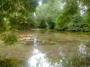
Saltaspring
| Saltaspring | |||
|---|---|---|---|
 Main source of the salt spring |
|||
| location | |||
| Country or region | Nordhausen district ( Thuringia ) | ||
| Coordinates | 51 ° 31 ′ 49 " N , 10 ° 45 ′ 41" E | ||
|
|||
| geology | |||
| Mountains | resin | ||
| Source type | Karst spring | ||
| Hydrology | |||
| River system | Elbe | ||
| Receiving waters | Salza → Helme → Unstrut → Saale → Elbe → North Sea | ||
| Bulk | 704 l / s | ||
| depth | 0.7 | ||
Coordinates: 51 ° 31 ′ 49 ″ N , 10 ° 45 ′ 41 ″ E
The Salzaspring or the Salza spring is a karst spring on the southern edge of the Harz Mountains in Nordhausen in northern Thuringia . It is Thuringia's strongest spring and the source of the Salza River .
location
The Salzaspring is located between the districts of Salza and Krimderode . The outflowing, about 5.6 km long Salza runs parallel to the Zorge and flows into the Helme in Niedersalza .
Data
The average discharge from the main source is 400 liters per second. With all secondary sources, such as the so-called Grundlose Loch , the total flow of the karst springs is 704 liters per second (213–1435 l / s). The maximum depth is 70 centimeters, the sulphate content is 800 mg / l.
Secondary sources
In addition to the main source, there are a few smaller secondary sources. The udder , the boot , the tobacco pouch and the tub . All feed the main spring pond. The Grundlose Loch is a little further south.
Groundless hole
| Groundless hole | |
|---|---|
| Coordinates | 51 ° 31 ′ 45 " N , 10 ° 45 ′ 50" E |
| Exit type | Sinkhole |
| Bulk | 60 l / s |
| depth | 3.5 m |
The water of the bottomless hole does not flow into the main spring pond, but into the Salza. With a sulphate content of 1,211 mg / l, it has the strongest karst water content of the Salza springs. Its average discharge is about 60 liters per second. The circular spring is a 3.5 meter deep collapse doline and is blue-green in color. The average temperature of the source water is 10.1 ° C .
Origin of the water
The origin of the water from the Salzaspring has not yet been scientifically proven. All information is based on assumptions. Its subterranean catchment area is believed to extend as far as the Tettenborn area . It can be assumed that the water of the karst spring comes from the many small shrinkage systems in the near and far surroundings. On the other hand, it is likely to be largely due to water emerging again from sinking rivers of the Wieda and Zorge , which flow under the Kohnstein and its Werra anhydrite and reappear here. The water flow of these rivers shows with a one-month delay in the pouring behavior of the Salzasprings.
See also
literature
- Josef Tauchmann: Thuringia's largest karst spring - the Salzaspring . In: Meyenburg Museum (ed.): Contributions to local history from the city and district of Nordhausen . Issue 17. Nordhausen 1992, p. 39-52 .


