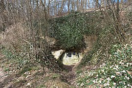
Blauhorn sand mine
| Blauhorn sand mine | |||
|---|---|---|---|
| General information about the mine | |||
| The entrance of the mine | |||
| Information about the mining company | |||
| Operating company | family business | ||
| Funded raw materials | |||
| Degradation of | sand | ||
| overall length | 630 m | ||
| Geographical location | |||
| Coordinates | 48 ° 58 '0.3 " N , 10 ° 7' 10.5" E | ||
|
|||
| country | State of Baden-Württemberg | ||
| Country | Germany | ||
The Blauhorn sand mine (also known as Blauhornbergwerk , Blauhornkeller ) is located in the Baden-Württemberg town of Ellwangen in the Ostalb district . It was intra-day construction and cleaning sand mined. With a total length of around 630 meters to 650 meters, it is the only accessible large sand mine in southern Germany. The mine is listed as a cultural monument in Ellwangen's list of monuments under the name Blauhornkeller .
geography
location
The entrance to the mine is in Ellwangen on Rübezahlweg, west of the Jagst and thus around 1.2 kilometers west of the city center. Immediately on the road, the tunnel goes north-westerly into the slope. After the entrance there are five chambers that are around 70 meters long and 5 meters wide.
geology
White quartz sand was extracted from the Upper Stubensandstein .
history
The Blauhorn family, who also gave the mine its name, had extracted sand here from 1900 to 1929 .
The rock sand was relatively easy to mine; only pickaxes and double hoes were used . There were no explosions . The material was transported into the open with carts , where it was further crushed and sieved. The sand for sale was then transported with handcarts and horse-drawn carts to the city and the surrounding area. Some of the sand was sent by rail to the Heilbronn area.
During the Second World War, the tunnels were used as an air raid shelter. Around 450 people belonged to the Haller Strasse protection community. After the war, the tunnel entrance was filled in to prevent accidents in the mine.
The Wildlife Protection Society of Germany (NABU) laid the early 1990s for the protection of bats the tunnel entrance free again and made the mine reopened. The mine is now owned by the city and is partly open to tourists for cave tours during the bat-free period and is part of the Ellwang Felsenkellerweg.
The mine is also a station on the Hariolf circular route, which was developed in 2014 by the Hariolf high school in Ellwangen.
literature
- H.-D. Bolter (2017). Blauhorn sand mine. Construction and cleaning sand for Ellwangen and the surrounding area. Aufschluss, vol. 68, no. 4, p.
- Various Authors (2017). H.-D. Bolter. Tiefer Stollen visitor mine, new mining path, Blauhorn sand mine in Ellwangen. Excursion guide: VFMG summer conference 2017. Aalen - O Schwäb. Alb and Nördlinger Ries v. 1st - 4th Sept. 2017. p. 27.
Web links
Individual evidence
- ↑ a b c d e f g h [ Internet source: archiv-url invalid Rübezahlweg, Ellwangen. ] (No longer available online.) In: wikimedia.org. 2018, archived from the original ; accessed on March 15, 2018 .
- ↑ a b c The Blauhorn mine should open for guided tours . In: Swabian . May 27, 2013 ( schwaebische.de ).
- ↑ Mineral Atlas - Fossil Atlas. In: mineralienatlas.de. Accessed March 15, 2018 (German).
- ↑ Rock cellars are intended to attract tourists . In: Swabian . December 9, 2011 ( schwaebische.de ).
- ↑ Ellwangen now has a Hariolf circular route . In: Swabian . July 29, 2014 ( schwaebische.de ).

