Saint Paul Island (Alaska)
| Saint Paul Island | ||
|---|---|---|
| Saint Paul Island | ||
| Waters | Bering Sea | |
| Archipelago | Pribilof Islands | |
| Geographical location | 57 ° 11 ′ N , 170 ° 16 ′ W | |
|
|
||
| surface | 104 km² | |
| Residents | 532 (2000) 5.1 inhabitants / km² |
|
| main place | Saint Paul | |
| Map of Saint Paul Island | ||
The Sankt Paul Island (English Saint Paul Island ) is the largest of the four Pribilof Islands and is located north of the Aleutian Islands in the Bering Sea . Like all the other islands in this archipelago, Saint Paul Island is of volcanic origin. Administratively, the 104 km² island belongs to the US state of Alaska .
Geography and population
| Saint Paul Island | ||||||||||||||||||||||||||||||||||||||||||||||||
|---|---|---|---|---|---|---|---|---|---|---|---|---|---|---|---|---|---|---|---|---|---|---|---|---|---|---|---|---|---|---|---|---|---|---|---|---|---|---|---|---|---|---|---|---|---|---|---|---|
| Climate diagram | ||||||||||||||||||||||||||||||||||||||||||||||||
| ||||||||||||||||||||||||||||||||||||||||||||||||
|
Monthly average temperatures and rainfall for Saint Paul Island
Source: wetterkontor.de
|
|||||||||||||||||||||||||||||||||||||||||||||||||||||||||||||||||||||||||||||||||||||||||||||||||||||||||||||||||||||||||||||||||||||||||||||||||||||||||||||||||||||||||||||||||||||||||||||||||||
Saint Paul Island has around 530 inhabitants, the vast majority of whom are native Alaskans from the Aleutian tribe .
history
In 1788 Gavriil Loginowitsch Pribylow discovered the island for Russia. In 1907 the church "Heilige Peters- und Paulskirche" was built by members of the Russian Orthodox Church on the island.
Infrastructure
In addition to ferry connections to the Alaskan mainland, the island also has its own airport .
Mammoths on Saint Paul
On Saint Paul Island, which was separated from Alaska by rising sea water after the last Ice Age 13,000 years ago, a population of woolly mammoth was discovered that had survived there until the mid-Holocene. They are relatively small woolly mammoths, but their small size is not considered to be a complete island dwarf like on Wrangel Island . The most recent data from the Qagnax Cave of Sankt Paul are 5,725 BP ( 14 C years), i.e. about 3700 BCE.
Trivia
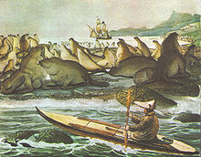
The island - more precisely the Novastoshnah peninsula (North East Point) - is the setting for the story "The White Seal" in Rudyard Kipling's " Jungle Book ". The song text "Lukannon" assigned to this story refers to the bay of Lukannon (Lukanin Bay) on the east coast, named after a fur trader named Lukanin.
Web links
Individual evidence
- ↑ JM Enk, DR Yesner, KJ Crossen, DW Veltre and DH O'Rourke: Phylogeographic Analysis of the mid-Holocene Mammoth from Qagnax Cave, St. Paul Island, Alaska. Palaeogeography, Palaeoclimatology, Palaeoecology 273 (1-2), 2009, pp. 184-190.
- ↑ Douglas W. Veltre, David R. Yesner, Kristine J. Crossen, Russell W. Graham and Joan B. Coltrain: Patterns of faunal extinction and paleoclimatic change from mid-Holocene mammoth and polar bear remains, Pribilof Islands, Alaska. Quaternary Research 2008, pp. 40-50.
- ↑ http://www.kiplingsociety.co.uk/rg_lukannon1.htm


