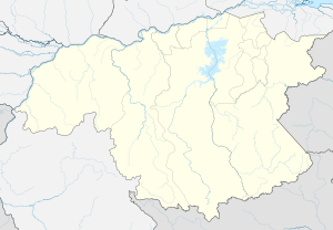
Sarisariñama tepui
| Sarisariñama tepui | ||
|---|---|---|
| height | 2300 m | |
| location | State of Bolívar , Venezuela | |
| Coordinates | 4 ° 33 ′ 0 ″ N , 64 ° 14 ′ 0 ″ W | |
|
|
||
| Type | Tepui | |
The Sarisariñama-Tepui is a 2300 m high tepui in the Jaua-Sarisariñama National Park in the extreme southwest of Bolívar in Venezuela , near the Brazilian border. The name is traced back to a legend of the Ye'kuana Indians living near the Tepuis , according to which an evil spirit in the caves of the Tepuis calls out " Sari, Sari " when people eat . It is considered a sinkhole .
Surface shape and vegetation
The Sarisariñama tepui has a surface of almost 547 km², its slopes cover 482 km². The plateau consists of quartzites of the Paleoproterozoic Roraima Formation. In contrast to many of the other tepuis in Guyana , Venezuela and Brazil, the Sarisariñama is densely forested on most of its surface, the trees reach a height of up to 25 m. The biodiversity of the Sarisariñama is relatively high compared to other tepuis; among others there is an endemic species of frog ( Stefania riae ).
History of exploration
The Sarisariñama tepui is several hundred kilometers from the nearest road. For this reason, details about him were not known for a long time. The first more detailed exploration took place in November 1964 during a flyover by the pilot Harry Gibson. The first landing on the Sarisariñama was made by William Henry Phelps, Jr. in March 1967. In February 1974, an expedition led by Charles Brewer-Carías , accompanied by scientists such as the botanist Julian Steyermark , the orchid experts "Stalky", visited Dunsterville and his wife Nora and the ornithologist William H. Phelps, Jr. first explored the shaft caves and also examined the plateau. Their findings showed that both harbor a unique ecosystem with numerous endemic animal and plant species.
The shaft caves of the Sarisariñama Tepuis
The Sarisariñama Tepui has several, somewhat irregularly delimited and elongated circular holes ( shaft caves ) with walls that drop vertically for several hundred meters. The shaft caves, probably collapse caves, a sinkhole type , were discovered in November 1964 when Harry Gibson flew over. The larger of the two caves initially discovered, the Sima Humboldt (often also Sima Major ) ( 4 ° 41 ′ 8 ″ N , 64 ° 13 ′ 7 ″ W ) named after Alexander von Humboldt , covers an area of 18 million cubic meters, is 350 Meters deep and has a diameter of 352 meters at the top and 502 meters at the bottom. The edge of the other of the two caves, the Sima Martel or Sima Menor named after Édouard Martel , is just 1.5 km southwest of the edge of the Sima Major and is 248 m deep. Two other shaft caves are known from the Sarisariñama tepui. Before the discovery of the Muchimuk cave system in the Churí-Tepui and the Cueva Ojos de Cristal in the Roraima-Tepui , the Sima de la Lluvia with its length of 1.35 km was for some time the longest known quartzite cave in the world.
further reading
- Charles Brewer-Cariás: Las Simas de Sarisariñama . In: Boletín Sociedad Venezolana de Ciencias Naturales La Salle . tape 132-133 . Caracas 1976, p. 549-623 .
Individual evidence
- ↑ Lindsay Elms: Mount Roraima: An Island Forgotten by Time. Retrieved January 7, 2010 .
- ^ Roy W. McDiarmid and Maureen A. Donnelly: The Herpetofauna of the Guayana Highlands: Amphibians and Reptiles of the Lost World . University of Chicago Press, 2005, pp. 469–472, 536 ( online version; PDF file; 3.3 MB ).
- ↑ a b Sima Humboldt and Sima Martel. In: Wondermondo, an armchair guide to world attractions. Retrieved January 7, 2010 .
- ↑ Stefania riae. International Union for Conservation of Nature and Natural Resources , accessed January 7, 2010 .
- ↑ a b Otto Huber and John J. Wurdack: History of Botanical Exploration in Territorio Federal Amazonas, Venezuela . In: Smithsonian Contributions to Botany . tape 56 . Smithsonian Institution Press, Washington DC 1984, pp. 8 ( online version; PDF file; MB ).
- ^ David Nott: Into The Lost World . Prentice-Hall, 1975, ISBN 0-13-477190-7 .
- ↑ Water is the key - chemical weathering processes in rock , Scinexx - Das Wissensmagazin, February 8, 2008, online , accessed: July 29, 2008
- ↑ Miguel Lentino, Diana Esclasans: Áreas Importantes Para La Conservación De Las Aves En Venezuela In: BirdLife International y Conservation International. Áreas Importantes para la Conservación de las Aves en los Andes Tropicales: sitios prioritarios para la Conservación de la biodiversidad. , Quito, Ecuador: BirdLife International (Serie de Conservación de BirdLife No. 14), p. 713, 2005, Online ( Memento of the original dated November 30, 2010 in the Internet Archive ) Info: The archive link was inserted automatically and has not yet been checked. Please check the original and archive link according to the instructions and then remove this notice. (PDF; 2.2 MB)
