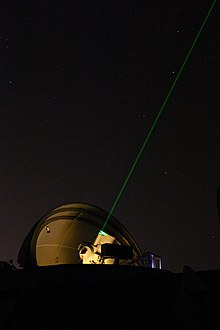
Satellite station
A satellite station is an observatory for the geodetic observation of artificial earth satellites and their orbits , whereby two or more measuring methods are used to determine direction and distance.
Initial stations
The first satellite stations were established in the USA, Western Europe and the Soviet Union in 1957-59, and later also in other industrialized and larger developing countries. Initially, the stations were equipped with optical measuring instruments or photographic satellite cameras, partly also with semi-automatic kinetheodolites . The satellite launches themselves were monitored with radio receivers for direction finding or with transit systems such as Minitrack . There were also numerous mobile stations for determining orbit , such as the Moonwatch teams in Western countries and analog groups in the Eastern Bloc.
The satellite cameras used were mostly ballistic cameras that had been developed earlier to measure flight paths, balloon probes or sounding rockets . Some long focal length cameras like the Russian KFA 1000 or AFU 75 or the American PC-1000 are converted astrographs or photogrammetry measuring chambers . Prototypes from individual university institutes were also used, but only the French IGN camera was built in large series.
Expansion to professional stations
The professional stations - many first by university institutes operated - have been supplemented from the early 1960s to more geometric and harmful methods of observation ( Satellite Laser Ranging , Doppler, Radar - or microwave - distance measurement ) and in many cases with accurate frequency standards equipped and atomic clocks. Some were taken over by specially founded state institutions in order to ensure long-term operation independent of research projects . Most observatories were integrated into a precise coordinate reference system by means of continental or worldwide triangular networks or time-limited measurement campaigns and from then on served as fundamental survey points for the countries concerned.
With the advent of the Global Positioning System (GPS), the importance of these stations and their particularly stable marketed fixed points decreased somewhat; some observatories were closed or - as at university institutes - only activated for certain times. Some, on the other hand, were expanded into fundamental stations and connected to work units with radio telescopes or geophysical measuring devices. The photographic cameras were partially converted to CCD .
Satellite stations in Central Europe
Important stations in Central Europe include:
- Wettzell in the Bavarian Forest (southern Germany)
- Potsdam SLR in Brandenburg (Northern Germany)
- Satellite station Graz-Lustbühel in Styria (Austria)
- Zimmerwald near Bern (Switzerland)
- Jozefoslaw near Warsaw (Poland)
- Ondřejov observatory in the Czech Republic
- Penc satellite station in Hungary.
Today around 200 permanent satellite stations are in operation worldwide, many of which contribute to the global coordinate reference system ITRF and the International Earth Rotation Service IERS . Thanks to international cooperation, the parameters of the earth's figure and the current rotation of the earth are known to within a few centimeters or microseconds .

