Schönberg (Bavarian Prealps)
| Schoenberg | ||
|---|---|---|
|
Schönberg from the Tegernsee plateau |
||
| height | 1620 m | |
| location | Bavaria , Germany | |
| Mountains | Bavarian Prealps ( Mangfall Mountains ) | |
| Dominance | 2.4 km → Roß- and Buchstein | |
| Notch height | 185 m ↓ saddle north of the Amperthalalm | |
| Coordinates | 47 ° 38 '20 " N , 11 ° 38' 38" E | |
|
|
||
| Normal way | Hike | |
|
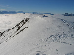
Summit of the Schönberg |
||
The Schönberg is a 1620 m high mountain in the Tegernsee Mountains , a subgroup of the Bavarian Prealps .
The summit can be reached from Lenggries (easy hike). The Schönberg is also often climbed on skis or snowshoes in winter . In the hollow northeast of the summit is the Rauhalm ( 1400 m ), which is used by the Munich section of the German Alpine Club as an alpine pasture in summer and as a self-catering hut in winter . The Almbach, Winkelbach and Klaffenbach have their source on the slopes of the Schönberg .


