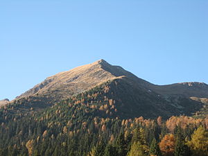
Schöngrubspitze
| Schöngrubspitze | ||
|---|---|---|
|
The Schöngrubspitze seen from the Clazner Alm |
||
| height | 2459 m slm | |
| location | South Tyrol , Italy | |
| Mountains | Ortler Alps | |
| Coordinates | 46 ° 30 '48 " N , 11 ° 1' 12" E | |
|
|
||
The Schöngrubspitze ( Italian Belmonte ) is a 2459 m slm high mountain in the Ilmenkamm of the Ortler Alps .
Location and surroundings
The Schöngrubspitze is located in South Tyrol ( Italy ) and separates the communities of Ulten in the north of Ultental and Proveis on the south of Deutschnonsberg . Three ridges lead to its summit. The west ridge continues over an intermediate summit ( 2488 m ) to the Ultner Hochwart , the northeast ridge to the Großer Kornigl . The southeast ridge slopes down towards the Val di Non .
Climbs
The summit can be reached via all three ridges. A ski route leads up over the notch between the Schöngrubspitze and the Großer Kornigl . You can also get to the summit via Clazner Loch , a basin between Kleines Kornigl , Großem Kornigl and Schöngrubspitze, and then on a path following the southeast ridge. The ascent from the west is made accessible by a path that leads from the Walschgrubenalm on the Ulten side to the ridge between Schöngrubspitze and Hochwart.
map
- Meran and surroundings , sheet 53, 1: 50,000, compass maps
Web links
- Schöngrubspitze on sentres.com (with a detailed map, ski tour description and pictures)

