Scarf (circle)
| شال scarf
|
|
|---|---|
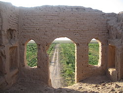
| A ruin near Cheyrabad in the Schal district | |
| Basic data | |
| Country | Iran |
| province | Qazvin |
| Shahrestan | Buinzahra |
| Seat | scarf |
| surface | 205 km² |
| Residents | 23,572 (2011 census) |
| density | 115 inhabitants per km² |
| ISO 3166-2 | IR-28 |
Coordinates: 35 ° 54 ' N , 49 ° 46' E
Scarf ( Persian شال[ ʃɑl ]) is a district in the Buinzahra administrative district in the Iranian province of Qazvin .
population
23,572 inhabitants live in the district of Schal, distributed among 6,373 families (as of 2011).
structure
The district of Schal is divided into a town, Schal , and two districts , Zeynabad and Ghalehaschem .
Individual evidence
- ↑ http://knti.ir/index.aspx?siteid=3&siteid=3&pageid=3812
- ↑ Archived copy ( memento of the original dated August 29, 2017 in the Internet Archive ) Info: The archive link was inserted automatically and has not yet been checked. Please check the original and archive link according to the instructions and then remove this notice.

